
Easiest route Drive up gravel road Prominence 415 m | Elevation 707 m | |
 | ||
Topo map USGS Roxbury (PA) Quadrangle Similar Parnell Knob, Sidneys Knob, Big Mountain, Butler Knob, Cross Mountain | ||
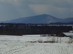
Clarks Knob is a summit in Franklin County, Pennsylvania. It is the highest point on Blue Mountain, the eastern front range of Pennsylvania's Ridge and Valley Appalachians region.
Contents
Map of Clarks Knob, Letterkenny Township, PA 17265, USA
GeographyEdit
Clarks Knob's northeast-southwest running summit ridge forms the boundary of the Susquehanna River and Potomac River drainages. It stands over 1,600 feet (488 m) above the town of Chambersburg and the Great Appalachian Valley. This mountain is protected within the Buchanan State Forest.
References
Clarks Knob Wikipedia(Text) CC BY-SA