
Founded December 25, 1830 Population 53,697 (2013) Unemployment rate 4.9% (Apr 2015) | Website www.co.coles.il.us | |
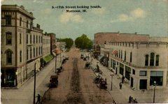 | ||
Rivers Embarras River, Polecat Creek, Whitley Creek Points of interest Unity Church, Lincoln Log Cabin State Hist, Morton Park, Douglas‑Hart Nature Center, The Dudley House | ||
Randy ervin for sheriff in coles county illinois
Coles County is a county located in the U.S. state of Illinois. As of the 2010 census, the population was 53,873. Its county seat is Charleston, which is also the home of Eastern Illinois University.
Contents
- Randy ervin for sheriff in coles county illinois
- Map of Coles County IL USA
- History
- Folklore
- Notable person
- Geography
- Climate and weather
- Adjacent counties
- Major highways
- Demographics
- Cities
- Villages
- Townships
- References
Map of Coles County, IL, USA
Coles County is part of the Charleston-Mattoon, IL Micropolitan Statistical Area.
History
Coles County was organized on December 25, 1830 out of Clark and Edgar counties. It was named after Edward Coles, the second governor of Illinois, from 1822 to 1826.
Folklore
Coles County is home to several well-known legends and folktales, including the Mad Gasser of Mattoon and the ghost of Mary Hawkins at Pemberton Hall. Michael Kleen has documented many of these tales, including the "witch's grave" of St. Omer Cemetery and story of "Rag Doll Cemetery," in his book Tales of Coles County, Illinois. The legend of "Rag Doll Cemetery" formed the basis of the independent film Rag Doll, which was filmed primarily in and around Mattoon, Illinois in 2010. Additionally, the novel A Family Possessed by L. W. Stevenson is based on poltergeist activity experienced by a rural family living in Coles County in the 1980s. Ashmore Estates has long been a part of local folklore. Originally the almshouse at the Coles County Poor Farm, it is now a haunted attraction and a place of interest for paranormal investigators.
Notable person
Geography
According to the U.S. Census Bureau, the county has a total area of 510 square miles (1,300 km2), of which 508 square miles (1,320 km2) is land and 1.8 square miles (4.7 km2) (0.4%) is water.
Climate and weather
In recent years, average temperatures in the county seat of Charleston have ranged from a low of 19 °F (−7 °C) in January to a high of 88 °F (31 °C) in July, although a record low of −27 °F (−33 °C) was recorded in January 1994 and a record high of 110 °F (43 °C) was recorded in July 1936. Average monthly precipitation ranged from 2.20 inches (56 mm) in January to 4.65 inches (118 mm) in July.
Adjacent counties
Major highways
Demographics
As of the 2010 United States Census, there were 53,873 people, 21,463 households, and 11,963 families residing in the county. The population density was 106.0 inhabitants per square mile (40.9/km2). There were 23,425 housing units at an average density of 46.1 per square mile (17.8/km2). The racial makeup of the county was 92.9% white, 3.8% black or African American, 1.0% Asian, 0.2% American Indian, 0.6% from other races, and 1.5% from two or more races. Those of Hispanic or Latino origin made up 2.1% of the population. In terms of ancestry, 25.6% were German, 16.4% were Irish, 11.1% were American, and 10.0% were English.
Of the 21,463 households, 25.5% had children under the age of 18 living with them, 41.8% were married couples living together, 9.9% had a female householder with no husband present, 44.3% were non-families, and 31.4% of all households were made up of individuals. The average household size was 2.30 and the average family size was 2.87. The median age was 31.6 years.
The median income for a household in the county was $36,457 and the median income for a family was $54,170. Males had a median income of $38,915 versus $28,781 for females. The per capita income for the county was $20,601. About 10.6% of families and 20.3% of the population were below the poverty line, including 20.6% of those under age 18 and 5.9% of those age 65 or over.
Cities
Villages
Townships
Coles County is divided into these twelve townships: