
Basin size 499 km (193 sq mi) Source elevation 765 m | Length 57 km | |
 | ||
Discharge Location:SninaAverage rate:2.85 m/s (101 cu ft/s) | ||
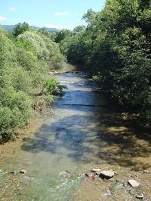
Cirocha (Hungarian: Ciróka) is a 56.6 km long river and tributary of Laborec in the Prešov Region of eastern Slovakia. Its watershed basin area is around 499 km², and the average flow is 2.85 m³/s in Snina.
Contents
Map of Cirocha, Slovakia
Course
The headwaters of the Cirocha are in the Bukovské vrchy mountains under the Ruské sedlo saddle at the Slovak-Polish border. It flows south and west after first few kilometres into the Starina reservoir, flowing further to the municipalities of Snina and Stakčín. From Stakčín it flows to the west, to its confluence with the Laborec river near Humenné.
References
Cirocha Wikipedia(Text) CC BY-SA