
Length 32.5 km | ||
 | ||
Similar Tiendesitas, Market! Market!, SM Aura Premier, SM Center Pasig, McKinley Hill Stadium | ||
Circumferential Road 5, more commonly known as C-5 Road or C-5, is a network of roads and bridges that altogether forms a major route that transverses in Metro Manila, in the National Capital Region of the Philippines. It is also known officially as Carlos P. Garcia Avenue, and as National Highway 11 (N11) in the National Route Numbering System implemented in 2014.
Contents
- Map of C 5 Metro Manila Philippines
- History
- Route description
- NLEX Karuhatan connector link
- NLEX Mindanao Avenue connector link
- Mindanao Avenue
- Congressional Avenue
- Luzon Avenue
- Tandang Sora Avenue
- Katipunan Avenue
- Bonny Serrano Avenue
- Eulogio Rodriguez Jr Avenue
- Carlos P Garcia Avenue
- Expansion
- South Extension Controversy
- West Valley Fault
- Commercial Areas
- Educational Institutions
- CemeteriesMemorial Parks
- Ecclesiastical Landmarks
- Others
- Exits and Intersections
- Transportation Links
- References
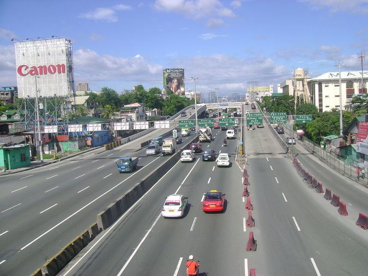
Map of C-5, Metro Manila, Philippines
The road serves as a beltway around Metro Manila, spanning some 32.5 kilometres (20.2 mi) as it transverses through the cities of Parañaque, Taguig, Makati, Pasig, Marikina, Quezon City and Valenzuela. It runs parallel to the four other beltways around Metro Manila, and is also known for being the second most important transportation corridor, after Circumferential Road 4, better known as EDSA.
The road is not yet complete to date, because of certain controversies regarding right of way, but portions of the road are already open for public use.
History
The proposal for the Metro Manila Arterial Road System was done in the late 1960s. The proposal states of building 10 Radial Roads and 6 Circumferential Roads to support the growing vehicular population of the Metropolitan Manila.
The 5th Circumferential Road began construction in 1986. Under the power of Republic Act 8224, which was passed in November 6, 1996, the C-5 road was legally known as President Carlos P. Garcia Avenue, honoring the eighth president of the Republic of the Philippines, Carlos P. Garcia.
Route description
The C-5 road lies parallel to Epifanio de los Santos Avenue, passing through the cities of Valenzuela, Quezon City, Marikina, Pasig, Makati, Taguig and Parañaque. The road is divided into segments.
NLEX-Karuhatan connector link
Also known as the NLEX Segment 9, the NLEX-MacArthur Highway connector is a 2.42 kilometres (1.50 mi) tollway starting from Smart Connect Interchange, a cloverleaf interchange between NLEX-Mindanao Avenue link, NLEX-Karuhatan link and the North Luzon Expressway. The western end of the road is located at MacArthur Highway in Karuhatan, Valenzuela and also a part of C-5 Road.
NLEX-Mindanao Avenue connector link
Also known as the NLEX Segment 8, the NLEX-Mindanao Avenue connector is a 2.7 kilometres (1.7 mi) tollway starting from the Smart Connect Interchange, a cloverleaf interchange between the NLEX-Mindanao Avenue link, NLEX-Karuhatan link and the North Luzon Expressway (NLEX) and ending in a 3-way signalized junction with the Mindanao Avenue. The entire 2.6 kilometres (1.6 mi) tollway is designated as part of a C-5 Road.
Mindanao Avenue
Mindanao Avenue is a 6.7 kilometres (4.2 mi), 10-lane divided carriageway that serves as the main transportation corridor of the Talipapa and Tandang Sora districts of Quezon City. The northern terminus of the road is a dead end 1.1 kilometres (0.68 mi) north of the NLEX-Mindanao Avenue Connector Road and the southern terminus of the road is the Epifanio de los Santos Avenue. The 3.5 kilometres (2.2 mi) portion of the road from the NLEX-Mindanao Avenue Connector Road junction to Congressional Avenue is designated as a portion of the C-5 Road.
Congressional Avenue
Congressional Avenue is a 6 kilometres (3.7 mi), 6-lane divided carriageway that serves as the main east to west transportation corridor of Muñoz, Culiat and Tandang Sora districts in Quezon City. The western terminus of the road is Epifanio de los Santos Avenue and the eastern terminus of the road is a junction with Luzon Avenue. The 3.9 kilometres (2.4 mi) portion of the road from Mindanao Avenue to Luzon Avenue is designated as a portion of C-5 Road.
Luzon Avenue
Luzon Avenue is a 2.5 kilometres (1.6 mi), 4-lane divided/undivided municipal road that serves as the main thoroughfare of the Holy Spirit district of Quezon City. The northern terminus of the road is a junction with Holy Spirit Drive and the southern terminus is a junction with Commonwealth Avenue. The 850 metres (2,790 ft) portion of the road from Congressional Avenue to Commonwealth Avenue is designated as a portion of C-5 Road. Before crossing ending in Commonwealth Avenue, a 6-lane flyover starts 850 metres (2,790 ft) north of the junction and heads towards Tandang Sora Avenue on the other side of Commonwealth Avenue.
Tandang Sora Avenue
Tandang Sora Avenue is a 9.6 kilometres (6.0 mi), 2-lane undivided municipal road that serves as the main thoroughfare of the Talipapa, Culiat and Tandang Sora districts of Quezon City. The northern terminus of the road is the Tullahan Road, while the southern terminus is the junction with Magsaysay Avenue inside the University of the Philippines campus. The original planned route of C-5 included the entire road, however, due to the incapacity of the road to carry a large amount of vehicular traffic, only the 1 kilometre (0.62 mi) portion of the road from the Luzon Avenue flyover to Magsaysay Avenue was designated as a portion of C-5 Road. Furthermore, Tandang Sora Avenue becomes a 6-lane divided carriageway shortly after crossing Capitol Hills Drive, 350 meters south of the flyover. After crossing Magsaysay Avenue, Tandang Sora Avenue becomes Katipunan Avenue.
Katipunan Avenue
Katipunan Avenue is a 7.3 kilometres (4.5 mi), 10-lane divided carriageway that serves as the main transportation corridor of the Balara and Project 4 districts of Quezon City. The northern terminus of the road is Tandang Sora Avenue and the southern terminus is Epifanio de los Santos Avenue. The 4.8 kilometres (3.0 mi) portion of the road from its northern terminus to the intersection with Col. Bonny Serrano Avenue is designated as a portion of C-5 Road. Shortly before crossing Bonny Serrano Avenue, a 4-lane divided underpass descends from Katipunan Avenue and traverses underneath Col. Bonny Serrano Avenue and ascends into a flyover that immediately connects to E. Rodriguez Jr. Avenue.
Bonny Serrano Avenue
Col. Bonny Serrano Avenue is a 2.2 kilometres (1.4 mi), 4-lane undivided avenue that serves as the main thoroughfare between Epifanio de los Santos Avenue and Eastwood City. The 500 metres (1,600 ft) portion of the road from Katipunan Avenue to Eulogio Rodriguez Jr. Avenue is designated as a portion of the C-5 Road. A 4-lane divided underpass descends from Katipunan Avenue and traverses underneath Col. Bonny Serrano Avenue and ascends into a flyover that immediately connects to E. Rodriguez Jr. Avenue.
Eulogio Rodriguez Jr. Avenue
Eulogio Rodriguez Jr. Avenue is a 6.7 kilometres (4.2 mi), 10-lane divided road that serves as the main thoroughfare between Quezon City and Pasig. The entire road, from Katipunan Avenue to Pasig Boulevard is designated as a portion of C-5 Road. The road ends in a junction with Pasig Boulevard and continues onto F. Manalo Bridge that crosses the Pasig River and eventually becomes C.P. Garcia Avenue shortly afterwards.
Carlos P. Garcia Avenue
Carlos P. Garcia Avenue is a 7.5 kilometres (4.7 mi), 14-lane divided road that serves as the main thoroughfare between Pasig and Parañaque, passing a small portion in Makati and continuously passing Taguig. The entire road, from the F. Manalo Bridge to South Luzon Expressway (SLEX) is designated as a portion of C-5 Road. The road ends in a junction with South Luzon Expressway.
Expansion
On July 23, 2007, President Gloria Macapagal-Arroyo announced on her State of the Nation Address that C-5 Road will be extended to the north of Metro Manila, from North Luzon Expressway in Quezon City to Navotas and will be extended in the south from South Luzon Expressway in Taguig-Parañaque boundary to Coastal Road in Las Piñas in the southern part of Ninoy Aquino International Airport.
As of June 2010, the NLEx-Mindanao Avenue Link or NLEx Segment 8.1 which is located in Valenzuela City and Congressional Avenue Extension from Tandang Sora to Luzon Avenue which is located in Quezon City has been opened to all motorists in the North Extension and also the SLEx-Sucat Link or Carlos Garcia Avenue Extension in the South Extension located in Parañaque was also opened.
As of March 2015, the NLEX-Karuhatan Link (Segment 9) has been opened to all motorists. The opening of the Segment 9 from NLEx to MacArthur Highway in Karuhatan, Valenzuela serves as a preparation for the Holy Week season.
At present, the New Commonwealth Avenue Flyover connecting Katipunan and Luzon Avenue is now open to all motorists. Before the opening of the flyover, the Congressional Avenue Extension from Visayas to Luzon Avenue opened in 2010 to decongest heavy traffic in Visayas-Tandang Sora Avenue Intersection.
South Extension Controversy
The Senate of the Philippines is investigating the South Extension since it passes many of Sen. Manny Villar's properties such as Camella. The original C5 South Extension was called MCTEP, and was already approved by the Senate. MCTEP was a road that would be made as a toll expressway and resurrected as CAVITEX-C5 Link.
West Valley Fault
Studies by the PHIVOLCS reveal that a large portion of the C-5 road is actually built on top of the West Valley Fault. A map of the fault line released in May 18, 2015 shows the C-5 road in Taguig beside the fault line. The C-5 road is prone to liquefaction.
Commercial Areas
Educational Institutions
These schools are located in Quezon City.
Cemeteries/Memorial Parks
Ecclesiastical Landmarks
Others
Exits and Intersections
A list of exits, flyovers, underpasses, and major intersections along C-5 Road. There are no exit numbers along C-5 Road. Instead, kilometer posts mark the location of exits and establishments along the road.