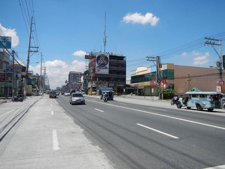
MacArthur Highway, also officially named the Manila North Road (Manor), is a major highway in northwestern Luzon, an island in the Philippines. This two- to six-lane national road stretches for 500 km (310 mi) from the Bonifacio Monument in Caloocan to the northern province of Ilocos Norte, passing through three cities in Metro Manila (Caloocan, Malabon, and Valenzuela), three provinces of Central Luzon (Bulacan, Pampanga and Tarlac), and four provinces of the Ilocos Region (Pangasinan, La Union, Ilocos Sur and Ilocos Norte).
The highway parallels the North Luzon Expressway from Epifanio de los Santos Avenue (EDSA) to Mabalacat, the Subic–Clark–Tarlac Expressway from Mabalacat to Tarlac City, and the Tarlac–Pangasinan–La Union Expressway from Tarlac City to Rosario. It is a component of N2 of the Philippine highway network and R-9 of Manila's arterial road network.
MacArthur Highway was built in sections beginning in 1928 during the American colonial period. It followed much of the route of the old Manila Railroad line from Manila to Dagupan. It was named Highway 3 and was also called Route 3 in early U.S. military records. The highway eventually reached the Ilocos provinces in the north and became known as the Manila North Road spanning a distance of over 500 km (310 mi).
On June 17, 1961, the section of the Manila North Road between Manila and Pangasinan was renamed in honor of the Liberator of the Philippines during World War II, General Douglas MacArthur.
Bonifacio Monument Roundabout Caloocan (South)
NLEX-Karuhatan Link (Valenzuela)
Maysan Road (Valenzuela)
Governor Fortunato Halili Avenue (Bocaue) – connects with NLEx-Bocaue Interchange
Tabang Spur Road and Pan-Philippine Highway (Maharlika Highway) (Guiguinto) – Tabang Spur Road connects with NLEx-Tabang Exit and Maharlika Highway goes to Cagayan Valley (Cagayan, Isabela, Quirino and Nueva Vizcaya), Aurora, Nueva Ecija and municipalities of Plaridel, Baliuag, San Rafael, San Ildefonso and San Miguel within Bulacan.
Pulilan Regional Road (Calumpit) – connects with NLEx-Pulilan Interchange and ends at the municipality of Pulilan
Jose Abad Santos Avenue (Olongapo-Gapan Road) (San Fernando, Pampanga) – The flyover above the intersection carries the Olongapo-Gapan Road. Turning left goes to Bataan, Zambales and municipalities of Bacolor, Lubao and Guagua within Pampanga and turning right goes to Nueva Ecija and Cagayan Valley. JASA connects with NLEx-San Fernando Interchange.
Pandan Road (Angeles) – connects with NLEx-Angeles Interchange
Manuel Roxas Highway (Angeles) – main entry point to Clark Freeport Zone
Dau Access Road (Mabalacat) – connects with NLEx-Dau Interchange
Clark Spur Road (Mabalacat) – connects with SCTEx-Mabalacat Interchange NLEx-SCTEx Exit
Mabalacat-Magalang Road (Mabalacat) – connects with the northern terminus of NLEx or NLEx-Santa Ines Interchange. Mabalacat-Magalang Road goes to the municipality of Magalang.
SCTEx-Dolores Interchange (Mabalacat) – SCTEx northbound goes to Tarlac for short travel time. It also serves as an alternate route to Nueva Ecija, Baguio, Pangasinan, Ilocos Provinces, Abra and La Union.
Concepcion-Magalang Road (Concepcion) – connects with SCTEx-Concepcion Interchange. Concepcion-Magalang Road intersects with Mabalacat-Magalang Road at Magalang, Pampanga.
Luisita Access Road and Romulo Highway (Tarlac City) – Luisita Access Road located at Hacienda Luisita connects with SCTEx-Hacienda Luisita Interchange, and Romulo Highway goes to western parts of Tarlac and Pangasinan.
Santa Rosa-Tarlac Road (Tarlac City) – the current northern terminus of SCTEx and the current southern terminus of Tarlac-Pangasinan-La Union Expressway. Santa Rosa-Tarlac Road goes to the municipality of La Paz, province of Nueva Ecija and Cagayan Valley Region.
Tarlac-Victoria Road (Tarlac City) – connects with TPLEx-Victoria Interchange
Gerona-Guimba Road (Gerona) – connects with TPLEx-Gerona Interchange. Eastern terminus located at Guimba, Nueva Ecija along Pangasinan-Nueva Ecija Road.
Paniqui-Ramos Road (Paniqui) – connects with TPLEx-Paniqui Interchange
Moncada-Anao Road (Moncada) – connects with TPLEx-Anao Interchange. Eastbound direction goes to Nampicuan and Cuyapo, Nueva Ecija.
Umingan - Rosales Road (Rosales) - goes to the town of Umingan in the province of Pangasinan and also goes to San Jose, Nueva Ecija.
Calasiao - Urdaneta Road (Urdaneta) - goes to Alaminos, Lingayen, Calasiao, and Dagupan.
TPLEx - Urdaneta Interchange (Urdaneta) - direct connection to the Urdaneta Exit of Tarlac-Pangasinan-La Union Expressway
Binalonan - Dagupan Highway (Urdaneta) - goes to the town of Manaoag and TPLEx-Binalonan Exit
Kennon Road (Rosario, La Union) - goes to the town of Tuba and city of Baguio in the province of Benguet
Pugo–Rosario Road (Rosario, La Union) - alternative entry point for vehicles from Manila going to Baguio thru Aspiras–Palispis Highway (Marcos Highway). Also goes to the town of Pugo
Pangasinan - La Union Road (Santo Tomas, La Union) - goes to Dagupan and San Fabian in Pangasinan
Aspiras–Palispis Highway (Marcos Highway / Agoo - Baguio Road) (Agoo, La Union) - main entry point for vehicles going to Baguio thru Aspiras-Palispis Highway
Bauang - Baguio Road (Naguilian Road) (Bauang, La Union) - alternative road for vehicles going up to Baguio, also passes thru Naguilian, La Union Burgos, La Union Sablan, Benguet
San Fernando Bypass Road (San Fernando, La Union) - this road gives motorists a way to avoid the heavy traffic in the downtown area of San Fernando. The northern terminus is located near San Fernando - San Juan boundary; the southern terminus is located in Barangay Parian, San Fernando.
Joaquin Ortega Highway (San Fernando, La Union) - goes to Poro Point, its seaport and San Fernando Airport. Exhibits a Monument to the Unknown Soldier
Bacnotan - Luna - Balaoan Road (Bacnotan, La Union)
Luna - Bangar Road (Bangar, La Union)
Tagudin - Cervantes - Sabangan Road (Tagudin, Ilocos Sur) - goes to Bessang Pass and Mountain Province
Narvacan - Bangued Road (Narvacan, Ilocos Sur) - goes to the province of Abra
Quezon Avenue (Bantay, Ilocos Sur) - main entry point to Vigan, the capital city of Ilocos Sur
Pinili - Nueva Era Road (Pinili, Ilocos Norte) - goes to the towns of Pinili, Nueva Era and Banna
Currimao Seaport Access Road (Currimao, Ilocos Norte)
Marcos Avenue (Batac, Ilocos Norte) - goes to the downtown areas of Batac and Paoay
Ilocos Norte - Apayao Road (Doña Josefa Llanes Escoda National Highway) (San Nicolas, Ilocos Norte) - goes to the towns of Sarrat, Dingras and Solsona in Ilocos Norte and to the province of Apayao
Laoag - Paoay Road (Airport Road) (Laoag, Ilocos Norte) - goes to Laoag International Airport and Fort Ilocandia Resort Hotel. Also goes to the town of Paoay
Laoag - Sarrat - Piddig - Solsona Road (J. P. Rizal Street) / Maharlika Highway (Gen. Segundo Avenue) (Laoag, Ilocos Norte) - northern terminus of Manila North Road in front of Ilocos Norte capitol. Aurora Park is situated in the middle near Gilbert Bridge.