
Country United States Elevation 479 ft (146 m) Local time Saturday 6:23 AM | Incorporated 1988 Time zone Central (CST) (UTC-6) Population 47,749 (2013) | |
 | ||
Weather 1°C, Wind E at 10 km/h, 67% Humidity Points of interest Butterfly House - Missouri, Museum of Transportation, Faust Park, St Louis Carousel at Faust Park, Central Park Chesterfi | ||
Chesterfield is a city in St. Louis County, Missouri, United States, and a Western suburb of St. Louis. As of the 2010 census, the population was 47,484, making it the state's fourteenth-largest city.
Contents
- Map of Chesterfield MO USA
- Ufo over chesterfield missouri ufo sightings 2015 ufo missouri
- Geography
- Demographics
- 2010 census
- 2000 census
- Ancient History
- Historical communities
- 1967 Tornado
- Incorporation as Chesterfield
- Flood of 1993
- Highways and major roads
- Public transportation
- Air
- Rail
- Primary and secondary schools
- Colleges and universities and trade schools
- Public libraries
- Economy
- Top employers
- Attractions
- Notable people
- References
Map of Chesterfield, MO, USA
The broader valley of Chesterfield was originally referred to as "Gumbo Flats", derived from its soil, which though very rich and silty, became like a gumbo when wet. Chesterfield is half the size of St. Louis.
Ufo over chesterfield missouri ufo sightings 2015 ufo missouri
Geography
Chesterfield is located about 25 miles (40 km) west of St. Louis, Missouri. According to the United States Census Bureau, the city has a total area of 33.52 square miles (86.82 km2), of which, 31.78 square miles (82.31 km2) is land and 1.74 square miles (4.51 km2) is water.
Portions of Chesterfield are located in the floodplain of the Missouri River, now known as Chesterfield Valley, formerly Gumbo Flats. This area was submerged during the Great Flood of 1993; higher levees built since then have led to extensive commercial development in the valley. Chesterfield Valley is the location of Spirit of St. Louis Airport, used for corporate aviation, as well as the longest outdoor strip mall in America. The remainder of Chesterfield is located on the bluffs above the floodplain, and includes residential and retail development. Chesterfield is also home to several mid- to high-rise buildings, the tallest being the Drury Plaza Hotel, which is 12 stories and 125 feet tall.
Demographics
According to the 2007-2011 American Community Survey estimate, the median income for a household in the city was $95,006, and the median income for a family was $88,568. Males had a median income of $94,322 versus $54,934 for females. The per capita income for the city was $51,725. About 1.7% of families and 4.0% of the population were below the poverty line, including 1.7% of those under age 18 and 3.3% of those age 65 or over.
2010 census
As of the census of 2010, there were 47,484 people, 19,224 households, and 13,461 families residing in the city. The population density was 1,494.1 inhabitants per square mile (576.9/km2). There were 20,393 housing units at an average density of 641.7 per square mile (247.8/km2). The racial makeup of the city was 86.5% White, 2.6% African American, 0.2% Native American, 8.6% Asian, 0.7% from other races, and 1.4% from two or more races. Hispanic or Latino of any race were 2.8% of the population.
There were 19,224 households of which 29.3% had children under the age of 18 living with them, 62.2% were married couples living together, 5.9% had a female householder with no husband present, 2.0% had a male householder with no wife present, and 30.0% were non-families. 26.1% of all households were made up of individuals and 11.6% had someone living alone who was 65 years of age or older. The average household size was 2.42 and the average family size was 2.94.
The median age in the city was 46.6 years. 22.3% of residents were under the age of 18; 5.7% were between the ages of 18 and 24; 19.5% were from 25 to 44; 32.5% were from 45 to 64; and 20.1% were 65 years of age or older. The gender makeup of the city was 47.8% male and 52.2% female.
2000 census
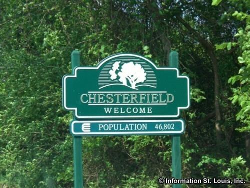
As of the census of 2000, there were 46,802 people, 18,060 households, and 13,111 families residing in the city. The population density was 1,485.4 people per square mile (573.5/km²). There were 18,738 housing units at an average density of 594.7 per square mile (229.6/km²). The racial makeup of the city was 92.30% White, 0.86% African American, 0.12% Native American, 5.56% Asian, 0.02% Pacific Islander, 0.39% from other races, and 0.74% from two or more races. Hispanic or Latino of any race were 1.55% of the population.
There were 18,060 households out of which 33.2% had children under the age of 18 living with them, 65.5% were married couples living together, 5.4% had a female householder with no husband present, and 27.4% were non-families. 23.6% of all households were made up of individuals and 8.8% had someone living alone who was 65 years of age or older. The average household size was 2.53 and the average family size was 3.03.
In the city the population was spread out with 24.6% under the age of 18, 5.9% from 18 to 24, 25.0% from 25 to 44, 29.7% from 45 to 64, and 14.7% who were 65 years of age or older. The median age was 42 years. For every 100 females there were 91.6 males. For every 100 females age 18 and over, there were 88.2 males.
Ancient History
Present-day Chesterfield is known to have been a site of Native American inhabitation for thousands of years. A site in western Chesterfield containing artwork and carvings has been dated as 4,000 years old. A Mississippian site, dated to around the year 1000, containing the remains of what have been identified as a market and ceremonial center, is also located in modern Chesterfield.
Historical communities
The present-day city of Chesterfield is made up of several smaller historical communities, including:
1967 Tornado
On January 24, 1967, a violent F4 tornado ripped a 21-mile (34 km) path of destruction across St. Louis County. It was the fourth-worst tornado to hit the St. Louis metro area and the most recent F4 tornado to hit the city. The tornado developed near the Chesterfield Manor nursing home and then moved through River Bend Estates and across northeast St. Louis County.
Incorporation as Chesterfield
For many years, "Chesterfield" was an all-inclusive place-name for a vast, unincorporated sub-region of western St. Louis County (called "West 'County" by metro area residents) containing the unincorporated historical communities listed above, plus areas now incorporated as cities of their own (e.g., Ballwin). Police and fire protection in the community were fragmented and sporadic, the former provided by St. Louis County. As the population grew, Chesterfield Mall and other retail and commercial real estate developments sprang up; however, many residents were concerned about the lack of quality public services, and that the municipal sales tax benefited the county instead of the community.
An organization was formed calling itself the "Chesterfield Incorporation Study Committee." Headed by its president, John A. Nuetzel (himself a former president of the River Bend Association, a zoning watchdog group), the members "passed the hat" at neighborhood meetings, engaged legal help, drew up metes and bounds, and forced several failed public votes for incorporation. After a number of years, in 1988, The City of Chesterfield was finally established by its residents, and has thrived as perhaps West County's premier residential, business, retail, and transportation center.
Flood of 1993
On July 30, 1993, the levee that protected Gumbo Flats (now known as the Chesterfield Valley) from the Missouri River failed. This was the first time the levee had failed since 1935. The town was told to evacuate, and the whole area of Gumbo Flats was flooded by feet of water. Today, the area has become the Chesterfield Commons retail area.
Highways and major roads
Interstate 64 runs East-West through Chesterfield. There are seven exits serving the city (numbers 14-21). Missouri Route 340 (a.k.a., Olive Blvd.) runs on East-West though much of Chesterfield, before turning Southwest near the I-64 Interchange; its name changes to Clarkson Road south of this junction. Missouri Route 141 (a.k.a., Woods Mill Road) runs along the eastern border between Chesterfield and Town and Country, Missouri. Route 141's northern terminus was, until recently, located in Chesterfield at Olive Blvd. The Missouri Department of Transportation (MoDOT) and St. Louis County Department of Highways and Traffic (DHT) began construction of Route 141 in Chesterfield in 2009. MoDOT expanded Route 141 between just south of Ladue Road (Route AB) to Olive Road (Route 340). DHT extends Route 141 from Olive Road to the Page Avenue Extension (Route 364) at the Maryland Heights Expressway.
Public transportation
Public transportation is provided by Metro and connects Chesterfield to many other portions of Greater St. Louis by numerous bus routes.
Air
Spirit of St. Louis Airport is located in the Chesterfield Valley; the airport is owned by St. Louis County.
Rail
Central Midland Railway (CMR), a division of Progressive Rail Inc. of Minnesota, provides regular freight rail service to industrial customers located in the Chesterfield Valley. CMR operates the far eastern segment of the former Chicago, Rock Island and Pacific Railway's St. Louis to Kansas City main line that was constructed in 1870. The active portion of the former CRI&P line runs from the north side of St. Louis, where it connects with the Terminal Railroad Association of St. Louis and Union Pacific Railroad, and now terminates in Union, Missouri. A primary rail customer in Chesterfield is a RockTenn (formerly Smurfit Stone) corrugated packaging plant which is located on a spur track that extends from the main track northward along the east end of the runway of the Spirit of St. Louis Airport. RockTenn typically receives inbound shipments of corrugated paper.
Primary and secondary schools
Chesterfield has a number of elementrary and middle schools, plus multiple high schools. The Rockwood School District serves the western portions of the city, while the Parkway School District serves the east. Chesterfield's sole private high school, Barat Academy, is located on the former Chesterfield campus of Gateway Academy, a former private elementary school. The city also has four private elementary schools: Chesterfield Day School, Chesterfield Montessori School, Ascension School, and Incarnate Word School.
Colleges and universities and trade schools
Logan College of Chiropractic offers undergraduate and graduate level courses on Chiropractic, Pre-Chiropractic, Sport Science and Rehabilitation medicine.
Public libraries
St. Louis County Library Samuel C. Sachs Branch is in Chesterfield.
Economy
Reinsurance Group of America, Dierbergs, Kellwood, Amdocs and Broadstripe have their headquarters in Chesterfield. Chesterfield has three malls, two of which are outlet malls as well as a strip mall called the Chesterfield Commons.
Top employers
According to the City's 2013 Comprehensive Annual Financial Report, the top employers in the city are:
Attractions
Faust Park contains an updated playground, historical village, walking trail, carousel, and the "The Butterfly House", which opened in 1998. A nearby giant cement butterfly sculpture by Bob Cassilly was dedicated in 1999.
The City has several recreation facilities including the Chesterfield Amphitheater, the Chesterfield Valley Athletic Complex, and the Chesterfield Family Aquatic Center.