
County Bates ZIP codes 64722, 64730 Elevation 265 m Population 367 (2000) | Time zone CST (UTC-6) GNIS feature ID 0766289 Area 93.15 km² Local time Friday 8:46 AM | |
 | ||
Weather 1°C, Wind E at 16 km/h, 73% Humidity | ||
Charlotte Township is one of twenty-four townships in Bates County, Missouri, USA. As of the 2000 census, its population was 367.
Contents
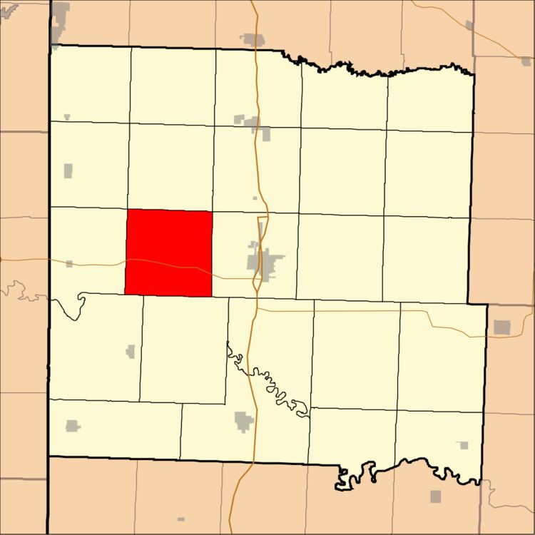
- Map of Charlotte Township MO USA
- Geography
- Unincorporated towns
- Adjacent townships
- Cemeteries
- Major highways
- Lakes
- Landmarks
- School districts
- Political districts
- References
Map of Charlotte Township, MO, USA
Geography
According to the United States Census Bureau, Charlotte Township covers an area of 35.97 square miles (93.15 square kilometers); of this, 35.87 square miles (92.91 square kilometers, 99.74 percent) is land and 0.09 square miles (0.24 square kilometers, 0.26 percent) is water.
Unincorporated towns
(This list is based on USGS data and may include former settlements.)
Adjacent townships
Cemeteries
The township contains these two cemeteries: Park and Virginia.
Major highways
Lakes
Landmarks
School districts
Political districts
References
Charlotte Township, Bates County, Missouri Wikipedia(Text) CC BY-SA