
Congressional district At-large Area 2,978 km² Population 9,241 (2013) | Founded 1862 Unemployment rate 4.3% (Apr 2015) | |
 | ||
Website charlesmix.sdcounties.org Rivers Missouri River, Choteau Creek, Benge Creek, Platte Creek | ||
Charles Mix County is a county located in the U.S. state of South Dakota. As of the 2010 census, the population was 9,129. Its county seat is Lake Andes. The county was created in 1862 and organized in 1879. It was named after Charles Eli Mix, an official of the Bureau of Indian Affairs influential in signing a peace treaty with the local Lakota Indian tribes. The easternmost approximately 60% of the county comprises the Yankton Indian Reservation.
Contents
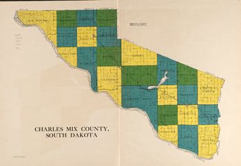
- Map of Charles Mix County SD USA
- Geography
- Major highways
- National protected areas
- 2000 census
- 2010 census
- Cities
- Towns
- Census designated place
- Townships
- Unorganized territory
- Notable residents
- References
Map of Charles Mix County, SD, USA
Geography
According to the U.S. Census Bureau, the county has a total area of 1,150 square miles (3,000 km2), of which 1,097 square miles (2,840 km2) is land and 53 square miles (140 km2) (4.6%) is water.
Major highways
National protected areas
2000 census
As of the census of 2000, there were 9,350 people, 3,343 households, and 2,326 families residing in the county. The population density was 8 people per square mile (3/km²). There were 3,853 housing units at an average density of 4 per square mile (1/km²). The racial makeup of the county was 69.65% White, 0.13% Black or African American, 28.28% Native American, 0.10% Asian, 0.01% Pacific Islander, 0.47% from other races, and 1.37% from two or more races. 1.89% of the population were Hispanic or Latino of any race. 23.9% were of German, 10.2% Czech, 10.1% Dutch and 5.5% Norwegian ancestry.
There were 3,343 households out of which 34.20% had children under the age of 18 living with them, 53.10% were married couples living together, 11.70% had a female householder with no husband present, and 30.40% were non-families. 28.30% of all households were made up of individuals and 15.10% had someone living alone who was 65 years of age or older. The average household size was 2.74 and the average family size was 3.37.
In the county, the population was spread out with 32.00% under the age of 18, 7.10% from 18 to 24, 23.20% from 25 to 44, 20.40% from 45 to 64, and 17.30% who were 65 years of age or older. The median age was 36 years. For every 100 females there were 96.60 males. For every 100 females age 18 and over, there were 94.10 males.
The median income for a household in the county was $26,060, and the median income for a family was $30,688. Males had a median income of $24,747 versus $19,688 for females. The per capita income for the county was $11,502. About 20.80% of families and 26.90% of the population were below the poverty line, including 35.50% of those under age 18 and 21.00% of those age 65 or over.
2010 census
As of the 2010 United States Census, there were 9,129 people, 3,249 households, and 2,222 families residing in the county. The population density was 8.3 inhabitants per square mile (3.2/km2). There were 3,849 housing units at an average density of 3.5 per square mile (1.4/km2). The racial makeup of the county was 65.0% white, 31.7% American Indian, 0.2% Asian, 0.1% black or African American, 0.3% from other races, and 2.7% from two or more races. Those of Hispanic or Latino origin made up 1.7% of the population. In terms of ancestry, 30.2% were German, 12.0% were Dutch, 11.7% were Czech, 6.8% were Norwegian, 5.1% were Irish, and 1.8% were American.
Of the 3,249 households, 33.7% had children under the age of 18 living with them, 50.0% were married couples living together, 12.9% had a female householder with no husband present, 31.6% were non-families, and 29.0% of all households were made up of individuals. The average household size was 2.63 and the average family size was 3.23. The median age was 38.2 years.
The median income for a household in the county was $35,808 and the median income for a family was $46,962. Males had a median income of $33,477 versus $25,740 for females. The per capita income for the county was $17,403. About 17.4% of families and 24.0% of the population were below the poverty line, including 32.9% of those under age 18 and 15.6% of those age 65 or over.
Cities
Towns
Census-designated place
Townships
The county is divided into twenty-four townships:
Unorganized territory
The unorganized territory of Castalia is located in the county.