
Basin countries United States | Catchment area 215 sq mi (560 km) | |
 | ||
Primary inflows Primary outflows | ||
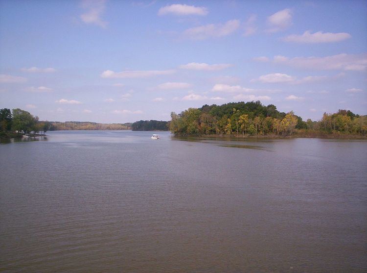
Charles Mill is a reservoir located in central Ohio near the junction of State Routes 430 and 603. Charles Mill Lake is a quiet and enjoyable place for boating, camping, fishing, hunting, or hiking. The lake is located in both Richland County (near Mansfield) and Ashland County (near Mifflin), with the dam located in Ashland County. This lake is located on the Black Fork of the Mohican River. Many local residents refer to Chales Mill Lake as Mifflin Lake due to its proximity to Mifflin, Ohio.
Contents
The lake primarily sees local use by nearby residents who fish or boat. The marina is accessible from St. Rt. 430, and there is a 10-HP (7.5 kW) limit for boats. The marina rents and sells various watercraft and provides licensing services.
HistoryEdit
There is a Historical Marker in the Day Use Area that recounts the stories of "Frontier Violence During the War of 1812" and "English-Allied Indian Attacks." An attack took place within a mile of the dam site following the removal of the Piqua Indians from their tribal home area. The Indians first attack the home of the Frederick Zimmer family, and their neighbor Martin Rufferner, killing four. Several days later four more persons {one pioneer and three militamen} were killed while defending the home of the James Copus family, including Rev. James Copus. As you drive South on Ohio State Route 603 watch for the sign directing you to a historical monument erected to the memory of those settlers and soldiers who were killed. In 2006 a new fence was erected around the momuent, a photo is included in the photo section on this site. Members of the Copus family have held an annual reunion in this picnic area for years.
Johnny AppleseedEdit
Tradition holds that Johnny Appleseed raced throughout the area warning others following the attacks. In 2004, the Johnny Appleseed Heritage Center opened nearby; the original production is no longer presented, check with the tourism number for their offerings.
Local HauntingsEdit
An eleven-foot-tall, 1,000 pound ape-like monster known as Orange Eyes has reportedly been terrifying residents near Ohio's Charles Mill Lake since 1959. But the popular recreation site is also said to be the home of an armless, web-footed, green-eyed creature known simply as the Mill Lake Monster. Even stranger, in October 1973, there was a bizarre encounter between a UFO and a military helicopter over the lake, leading many people to believe Orange Eyes and the Mill Lake Monster might be extraterrestrial in origin.
Charles Mill DamEdit
Charles Mill Dam, near 40°44′25″N 082°21′45″W Elevation: 1,017 feet (310 m), approximately 3 miles (4.8 km) East of I-71. At I-71, take US Route 30 East almost 1 mile (1.6 km) to Ohio State Route 603. Then take Ohio State Route 603 South about 2 miles (3.2 km) to dam.
Charles Mill Dam is located on the Black Fork of the Mohican River, 10 miles (16 km) East of Mansfield, Ohio and 10 miles (16 km) South-West of Ashland, Ohio. The lake is located in Ashland County, Ohio and Richland County, Ohio with the dam being located in Ashland County, Ohio. Charles Mill Dam was constructed in 1935 and 1936 and is primarily for flood control but also for recreation and fish and wildlife management.
Charles Mill Dam is a rolled earth fill dam with an impervious, water resistant, clay core. The dam, is 48 feet (15 m) high, 1,390 feet (420 m) long and 20 feet (6.1 m) wide. This flood reduction system also includes two dikes and one levee. These structures, the dam, dikes and levee, hold the water that may build up behind them from the 215 square miles (560 km2) drainage area the dam serves. The dam also has two spillways to handle water above the maximum the dam is designed to hold; one is built into the gate house, the other is beyond the gate house against the right abutment. There are five gates which allow the water to pass through the dam and provide control of it. During the summer months the lake is kept at about 31 feet (9.4 m) at the dam which provides 1,350 acres (5.5 km2) of water surface. At that level the water is backed up the Black Fork about 5.2 miles (8.4 km). When the dam is holding the maximum flood water it is designed to hold there would be 6,050 acres (24.5 km2) surface acres of water behind the dam and water would be backed up the Black Fork 19.8 miles (31.9 km).