
 | ||
Faulty thinking a study on groundwater flow around the champlain thrust
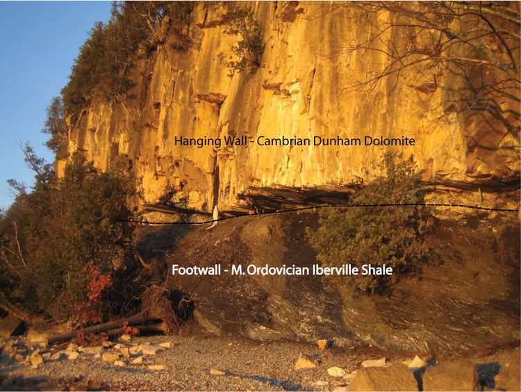
The Champlain Thrust is a 200-mile long fault extending from southern Quebec, down through western Vermont in the Champlain Valley, and into eastern New York in the Catskills/Hudson Valley. This east dipping thrust fault transports Cambrian-Ordovician passive margin shelf rocks westward by about 30–50 miles (48–80 km) and places them on top of Middle Ordovician rocks. The Middle Ordovician accretion of the one or more island arcs terranes drove the initial thrusting during the Taconic Orogeny, though reactivation of the fault may have occurred during the middle Devonian Acadian Orogeny. The Champlain Thrust marks the most westerly thrust of the Taconic Orogeny.
Contents
- Faulty thinking a study on groundwater flow around the champlain thrust
- Prominent exposures
- References
Prominent exposures
The thrust fault is exposed to the north of the city of Burlington, Vermont on the shores of Lake Champlain at Lone Rock Point. Here the Lower Cambrian Dunham dolostone can be seen thrust on top of the Middle Ordovician Iberville shales.