
Country Indonesia Languages spoken Area 153,564.5 km2 | Capital Palangkaraya Governor PDI-P Population 2.212 million (May 1, 2010) | |
Central Kalimantan (Indonesian: ) is a province of Indonesia. It is one of five provinces in Kalimantan, the Indonesian part of Borneo. Its provincial capital is Palangkaraya and in 2010 its population was over 2.2 million, while the latest official estimate (for January 2014) is 2,368,654.
Contents
Map of Central Kalimantan
The population growth rate was almost 3.0% per annum between 1990 and 2000, one of the highest provincial growth rates in Indonesia during that time; in the subsequent decade to 2010 the average annual growth rate slowed markedly to around 1.8%. More than is the case in other province in the region, Central Kalimantan is populated by the Dayaks, the indigenous inhabitants of Borneo.
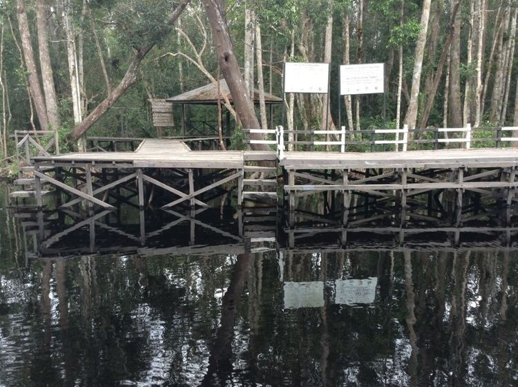
Rc boat on bagugus lagoon kalimantan tengah
History
Since the eighteenth century the central region of Kalimantan and its Dayak inhabitants were ruled by the Muslim Sultanate of Banjar. Following Indonesian independence after World War II, Dayak tribes demanded a province separate from South Kalimantan province.
In 1957 South Kalimantan was divided to provide the Dayak population with greater autonomy from the Muslim population in the province. The change was approved by the Indonesian Government on 23 May 1957 under Presidential Law No. 10 Year 1957, which declared Central Kalimantan the seventeenth province of Indonesia. President Sukarno appointed the Dayak-born national hero Tjilik Riwut as the first Governor and Palangkaraya the provincial capital.
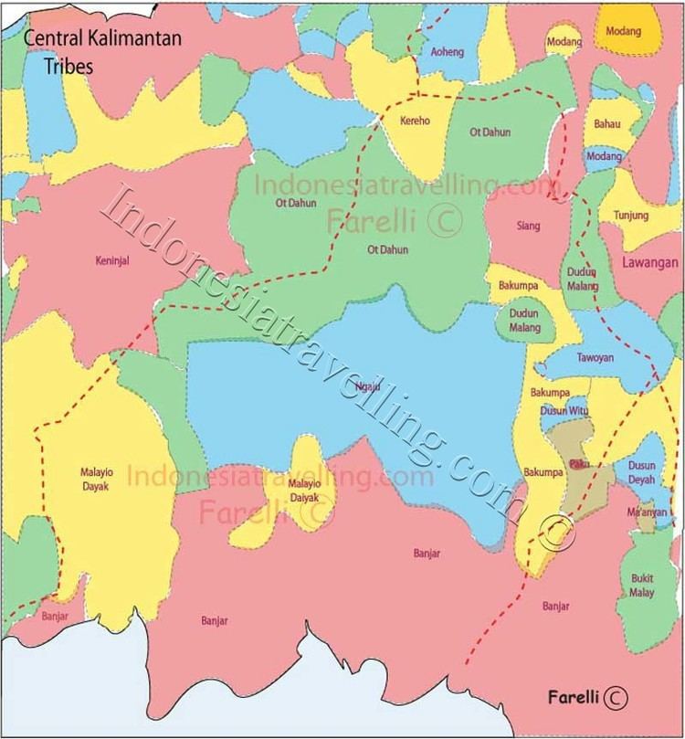
The three major Dayak tribes in Central Kalimantan are the Ngaju, Ot Danum and Dusun Maanyan Ot Siang. The three major tribes extended into several branches of prominent Dayak tribes in Central Kalimantan such as Lawangan, Taboyan, Dusun Siang, Boyan, Bantian, Dohoi and Kadori.
In addition to the indigenous Dayak tribes, the province also groups from other areas of Indonesia, including Javanese, Maduranese, Batak, Toraja, Ambonese, Bugis, Palembang, Minang, Banjarese, Makassar, Papuan, Balinese, Acehnese and also Chinese.
Geography
Central Kalimantan is the third largest Indonesian province by area with a size of 153,564.5 km2, about 1.5 times the size of the island of Java. It is bordered by West Kalimantan and East Kalimantan provinces to the north, by the Java Sea to the south, by South Kalimantan and East Kalimantan provinces to the east, and by West Kalimantan province to west.
The Schwaner Mountains stretch from the north-east of the province to the south-west, 80% of which is covered in dense forest, peatland swamps, mangroves, rivers, and traditional agriculture land. Highland areas in the north-east are remote and not easily accessible. Non-volcanic mounts are scattered in this area including Kengkabang, Samiajang, Liang Pahang and Ulu Gedang.
The centre of the province is covered with tropical forest, which produces rattan, resin and valuable timber such as Ulin and Meranti. The southern lowlands are dominated by peatland swamps that intersect with many rivers. Sabangau National Park is a protected peatland area internationally acknowledged as sanctuary for the endangered Orangutan. Recently the peat swamp forests have been damaged by the Mega Rice Project, which unsuccessfully sought to turn large areas into rice paddies.
The provinces climate is wet weather equatorial zone with an eight-month rainy season, and 4 months of dry season. Rainfall or precipitation is 2,776 - 3,393 mm per year with an average of 145 rainy days annually.