
Area 121.4 km² | Designated June 18, 1991 | |
 | ||
Surface area 30,000 acres (12,000 ha) | ||
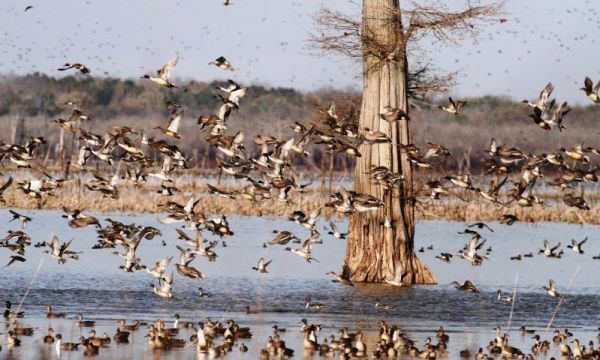
Louisiana duck hunting at catahoula lake honey brake josh dahlke
Catahoula Lake is a large freshwater lake located in La Salle Parish and Rapides Parish of central Louisiana, United States.
Contents
- Louisiana duck hunting at catahoula lake honey brake josh dahlke
- Map of Catahoula Lake Louisiana USA
- References
Map of Catahoula Lake, Louisiana, USA
Catahoula Lake is the largest natural freshwater lake in the state covering just over 46 square miles (120 km2). It is owned by the State of Louisiana and managed by the U.S. Army Corps of Engineers, the U.S. Fish and Wildlife Service, and the Louisiana Department of Wildlife and Fisheries.
Catahoula is a shallow, and poorly drained wetland supported by the Little River and several creeks. It was drained by the Old River, French Fork and a number of bayous until several flood control projects changed the lake's drainage characteristics.
It is known as the largest moist soil unit in North America and supports a variety of waterfowl including geese, duck, and wading birds and is a recreational area for hunting, fishing, hiking, sight seeing, and bird watching. Access to the lake is limited on the western shores due to private and corporate fencing.