
Existed: 1933 – present Constructed 1933 | Length 51.5 km Major cities Hong Kong | |
 | ||
North end: Fan Kam Road at Sheung Shui | ||
18 castle peak road ting kau autoguard
Castle Peak Road is the longest road in Hong Kong. Completed in 1933, it runs from Tai Po Road in Sham Shui Po, Kowloon to the very north of the New Territories, serving south, west and north New Territories, being one of the most distant roads in early Hong Kong.
Contents
- 18 castle peak road ting kau autoguard
- Map of Castle Peak Rd Ting Kau Hong Kong
- castle peak road cheung sai wan hong kong
- Name
- Kowloon
- New Territories
- References
Map of Castle Peak Rd (Ting Kau), Hong Kong
castle peak road cheung sai wan hong kong
Name
The road was named after Castle Peak, a peak in the western New Territories. The area to the east of the peak was hence named Castle Peak. Later at the dawn of the development of new town, the area was renamed to its old name, Tuen Mun.
The road was originally known in Chinese as Tsing Shan To (青山道) for its entire length. The Chinese name of the section of the road in the New Territories was later changed to Tsing Shan Kung Lo (青山公路) Lit. "Castle Peak public road" or "Castle Peak Highway". In everyday conversation, however, the term Tsing Shan To survives for the stretches within Tsuen Wan and Yuen Long.
Kowloon
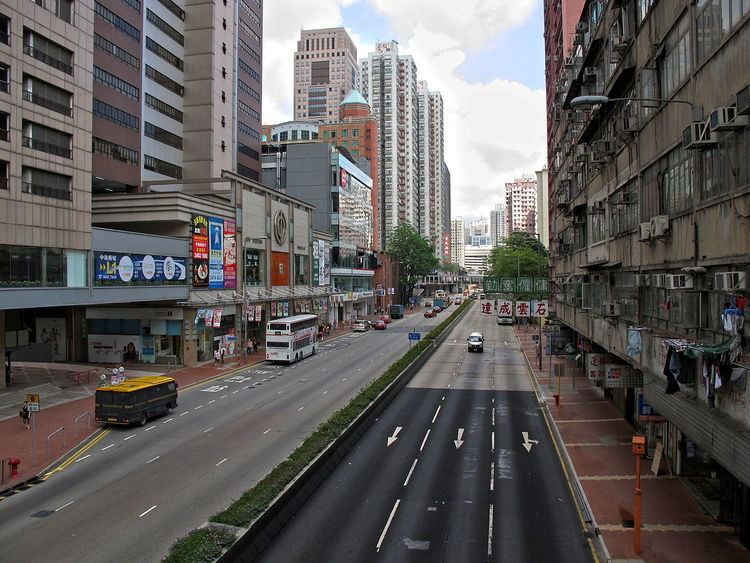
The road starts east at Tai Po Road in Sham Shui Po and passes through Cheung Sha Wan and Lai Chi Kok in Kowloon. On both sides of the road are old residential blocks, with some dated back to pre-World War II. Towards Lai Chi Kok, it is surrounded by industrial buildings instead. The road is one-way eastbound between Kom Tsun Street & its terminus at Tai Po Road.
New Territories
After leaving Kowloon, it goes uphill past Kau Wa Keng and Tai Ching Cheung along a four-lane expressway to Kwai Chung and downhill into Tsuen Wan. The stretch within Tsuen Wan is also commonly called the Main Thoroughfare (大馬路), especially among the older generations.
Next, it goes along the south shore of the Western New Territories, via Yau Kom Tau, Ting Kau, Sham Tseng, Tsing Lung Tau, Tai Lam, Siu Lam and So Kwun Wat and then reaches the Tuen Mun New Town, which was also known as Castle Peak (after which the road was named). Much of this stretch was bypassed by Tuen Mun Road between 1977 and 1983.
It continues north-east as a six-laned road, paralleling the Light Rail through Lam Tei, Hung Shui Kiu, Ping Shan and goes through another new town, Yuen Long New Town. The section within Yuen Long, again, is also called 大馬路. This section was bypassed by the Yuen Long Highway in 1992.
It then turns north at Au Tau, just west of Kam Tin. This section is overshadowed by the San Tin Highway, constructed between 1991 & 1993. It then passes through Mai Po, San Tin, Lok Ma Chau (near the Mainland border), Pak Shek Au and Kwu Tung before terminating at Fan Kam Road in Sheung Shui.