
Operator ISRO Reference system Geocentric Launch date 10 January 2007 Inclination 97.91° | COSPAR ID 2007-001B Rocket PSLV C7 Regime Sun-synchronous Inclination 97.91° Launch mass 680 kg | |
 | ||
Similar Cartosat‑1, Cartosat‑2A, Resourcesat‑1, Cartosat‑2B, Swayam | ||
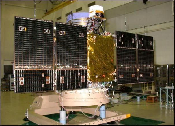
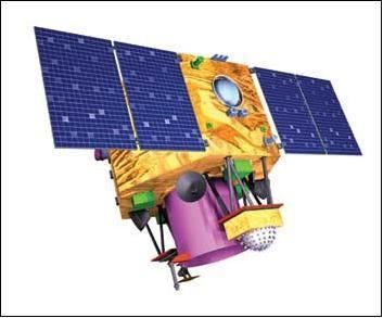
Cartosat-2 is an Earth observation satellite in a sun-synchronous orbit and the second of the Cartosat series of satellites. The satellite was built, launched and maintained by the Indian Space Research Organisation. Weighing around 680 kg at launch, its applications will mainly be towards cartography in India. It was launched by the PSLV on January 10, 2007.
Contents
Cartosat 2 earth observation satellite designed by isro pslv c34
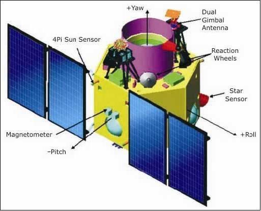
Description
Cartosat-2 carries a state-of-the-art panchromatic (PAN) camera that take black and white pictures of the earth in the visible region of the electromagnetic spectrum. The swath covered by this high resolution PAN camera is 9.6 km and their spatial resolution is less than 1 metre. The satellite can be steered up to 45 degrees along as well as across the track.
Cartosat-2 is an advanced remote sensing satellite capable of providing scene-specific spot imagery. The data from the satellite will be used for detailed mapping and other cartographic applications at cadastral level, urban and rural infrastructure development and management, as well as applications in Land Information System (LIS) and Geographical Information System (GIS).

The first imagery, received on January 12, 2007, covered a length of 240 km from Paonta Sahib in Shivalik region to Delhi. Another set of imagery of about 50 km length covered Radha Nagari to Sagoan in Goa. Analysis of the first imagery received at National Remote Sensing Agency's data reception station at Shadnagar, in Hyderabad, confirmed excellent performance of the on-board camera.
Cartosat-2 can produce images of up to 100 cm in resolution (black and white only), compared to the 80 cm offered by Ikonos which is multispectral. In the past, India used to buy images from Ikonos at about $20 per square kilometre of imagery (where regional pricing was valid), otherwise the price is $7.70 per square kilometer. With Cartosat-2 offering better resolution at twenty times lower cost per square metre of imagery, buying images from Ikonos is likely to decline in future. Currently, India buys images worth about Rupees 2 crores in a year from Ikonos.