
 | ||
The Cartosat series of satellites are a type of earth observation satellites indigenously built by India. Up till now 6 Cartosat satellites have been launched by ISRO. The Cartosat series is a part of the Indian Remote Sensing Programme. They were specifically launched for Earth’s resource management and monitoring.
Contents
History
The first Cartosat satellite was Cartosat-1 which was launched by PSLV-C6, on May 5th2005 from the then newly built Second Launch Pad at Sriharikota. Department of Space (DOS), Government of India had earlier launched a series of satellites for Earth’s resource management and monitoring. These satellites had been very successful in providing data in various scales ranging from 1:1 Million to 1:12,500 scale. Each of the Indian Remote Sensing satellite missions ensured data continuity while introducing improvements in the spatial, spectral and radiometric resolutions. Considering increase demand for large scale and topographic mapping data DOS launched the Cartosat-1 in 2005.
Cartosat-1
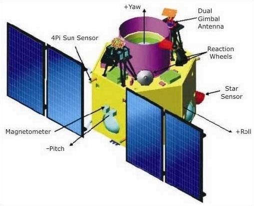
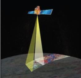
Cartosat-1 was launched by PSLV-C6 on 5 May 2005 from Satish Dhawan Space Centre's SLP at Sriharikota. Images from the satellite is available from GeoEye for worldwide distribution. The satellite covers the entire globe in 1867 orbits on a 126-day cycle. It carries two state-of-the-art panchromatic (PAN) cameras that take black and white stereoscopic pictures of the earth in the visible region of the electromagnetic spectrum. The two cameras with 2.5 m spatial resolution, acquire two images simultaneously, one forward looking (FORE)at +26 degrees and one aft of the satellite at -5 degrees for near instantaneous stereo data. The time difference between the acquisitions of the same scene by the two cameras is about 52 seconds.
Cartosat-2
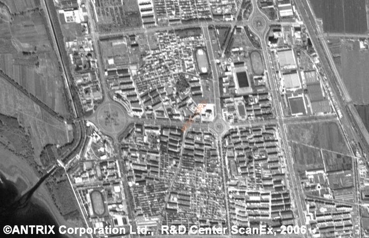
Cartosat-2 was launched by PSLV-C7 on 10 January 2007 from Satish Dhawan Space Centre's FLP at Sriharikota. Cartosat-2 carries a state-of-the-art panchromatic (PAN) camera that take black and white pictures of the earth in the visible region of the electromagnetic spectrum. The swath covered by this high resolution PAN camera is 9.6 km and their spatial resolution is less than 1 metre. The satellite can be steered up to 45 degrees along as well as across the track. Cartosat-2 is an advanced remote sensing satellite capable of providing scene-specific spot imagery. The data from the satellite is used for detailed mapping and other cartographic applications at cad-astral level, urban and rural infrastructure development and management, as well as applications in Land Information System (LIS) and Geographical Information System (GIS).
Cartosat-2A
Cartosat-2A was launched by PSLV-C9 on 28 April 2008 from Satish Dhawan Space Centre's SLP at Sriharikota along with 9 other satellites. It is a dedicated satellite for the Indian Armed Forces which is in the process of establishing an Aerospace Command. The satellite carries a panchromatic (PAN) camera capable of taking black-and-white pictures in the visible region of electromagnetic spectrum. The highly agile Cartosat-2A can be steered up to 45 degrees along as well as across the direction of its movement to facilitate imaging of any area more frequently.
Cartosat-2B
Cartosat-2B was launched by PSLV-C15 on 28 April 2008 from Satish Dhawan Space Centre's FLP at Sriharikota. The satellite carries a panchromatic (PAN) camera capable of taking black-and-white pictures in the visible region of electromagnetic spectrum. The highly agile CARTOSAT-2B can be steered up to 26 degrees along as well as across the direction of its movement to facilitate imaging of any area more frequently.
Cartosat-2C
Cartosat-2C is a much more capable satellite, having a resolution of 25 cm (10"). It uses 1.2 m optics with 60% of weight removal compared to Cartosat-2. Other features include the use of adaptive optics, acousto optical devices, in-orbit focusing using MEMs and large area-light weight mirrors. The satellite was to be launched on board PSLV during 2014, but had been delayed and was finally launched on 22 June 2016. Potential uses include weather mapping, cartography, and strategic applications.
Cartosat-2D
Cartosat-2D was launched by PSLV-C37 on 15 February 2017 from Satish Dhawan Space Centre's FLP at Sriharikota.