
Length 12.1 km | ||
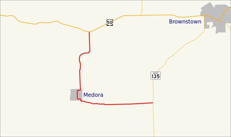 | ||
State Road 235 in the U.S. state of Indiana is a short route in southwest Jackson County.
Contents
Map of IN-235, Indiana, USA
Route description
State Road 235 begins at State Road 135 east of Medora and southwest of Brownstown. The road travels west to Medora, which it reaches after about 3.5 miles (5.6 km). The Medora Covered Bridge parallels the road as it crosses the East Fork of the White River. Leaving Medora, the road travels north to U.S. Route 50.
History
SR 235 in the 1930s was originally part of US 50.
Major intersections
The entire route is in Jackson County.
References
Indiana State Road 235 Wikipedia(Text) CC BY-SA