
Established December 1996 Website www.cctrail.org | Use Hiking, Biking Length 17,703 m | |
 | ||
Trailheads South: Georgetown, North: Silver Spring | ||
The Capital Crescent Trail (CCT) is an 11-mile (18 km) long, shared-use rail trail that runs from Georgetown in Washington, D.C., to Silver Spring, Maryland. The portion from Bethesda to Silver Spring is also called the Georgetown Branch Trail but is recognized as the Future Capital Crescent Trail.
Contents
Map of Capital Crescent Trail, United States
The Capital Crescent Trail is the most heavily used rail trail in the United States and is used by more than 1 million walkers, joggers, bikers, skateboarders and rollerbladers each year. In 2005, it was named one of the "21 great places that show how transportation can enliven a community" by The Project for Public Spaces.
History
The trail runs on the abandoned right-of-way of the Georgetown Branch rail line of the Baltimore and Ohio Railroad. The rail line was partially built in 1892 and completed in 1910. It served Potomac Electric Power Company (PEPCO), the Washington Mill and Federal government buildings; but with the changing use of Georgetown's waterfront, became obsolete. Trains stopped running on the line in 1985 and it was formally abandoned in 1988.
Advocates for turning the railroad into a trail began to lobby local and federal officials and, despite opposition from neighbors including former Secretary of State Edmund Muskie and those who wanted the right-of-way for mass transit or other development, they were able to convince the Montgomery County Government, along with a coalition of developers and government agencies, to purchase the right-of-way from the D.C. line to Silver Spring under the National Trails System Act of 1968 in 1988. CSX sold the line for $22 million. The following year, the County voted to build a trolley and bike trail along the Bethesda-Silver Spring section of the right-of-way.
In 1990 the National Park Service, with help from philanthropist Kingdon Gould, Jr., purchased about 4.3 miles (6.9 km) of right-of-way in the District of Columbia from Georgetown to the D.C./Maryland boundary and developed the trail as a component of the Chesapeake and Ohio Canal National Historical Park.
With the right-of-way secured, work on the trail began shortly thereafter. Volunteers built a wooden deck over the Arizona Avenue Railroad Bridge in 1990. In 1991, advocates John Dugger and Henri Bartholomot helped secure federal Intermodal Surface Transportation Efficiency Act funding to develop the Maryland portion of the trail. Work on the portion in the District began in 1992 and work on the 7-mile (11 km) section from the District to Bethesda began in spring of 1994. The section from Bethesda to Silver Spring, however, was delayed due to continued debate over the proposed trolley.
The trail was built in several segments, by different agencies. The first section of the trail to open, in April 1995, was built by PEPCO in exchange for easement considerations elsewhere and ran from Bethesda Avenue to Little Falls Parkway. Montgomery County, with financial assistance from Maryland and the federal government and planning from the Maryland-National Capital Park and Planning Commission, built the section from Little Falls Parkway to the District Line. Arlington County, oddly, built a section of the trail near Dalecarlia Reservoir because they were doing unrelated work on pipelines in the area. Finally, the National Park Service built the section from Dalecarlia Reservoir to Georgetown, with all of the work except for the Arizona Avenue Trestle completed in 1994. In 1995, the concrete deck of the trestle was poured, replacing the wooden deck built 5 years earlier. In 1996 a trail bridge was opened over busy River Road and the Dalecarlia Bridge was completed. The Dalecarlia Bridge includes a component of a bridge which formerly took the Georgetown Branch over the Washington and Great Falls Electric Railway and it was designed to go over a road connecting two parts of the Washington Aqueduct reservation. In June of that year the final piece of the trail between Bethesda and Georgetown was completed when the Arizona Avenue Trestle was finally opened. The trail was formally dedicated in December 1996.
The trail continued to expand and improve while gaps were closed. On May 17, 1997, the Georgetown Branch Interim Trail, from the east side of the Air Rights Tunnel in Bethesda to Stewart Avenue in Silver Spring opened. On August 15, 1998, the Air Rights Tunnel in Bethesda (built in 1910) was opened to trail traffic, connecting the paved and unpaved portions. In June 2000, Montgomery County committed $1.3 million to repair the Rock Creek Trestle, which had been damaged by arson, and open it for trail use. The trestle was dedicated for trail use on May 31, 2003. An unpaved trail connection to Norton Street, NW and a staircase connection to Potomac Avenue, NW were built around the same time.
Description
The trail starts at Lyttonsville Junction, about one mile (1.6 km) west of downtown Silver Spring. The "future" section goes west on an unpaved, crushed stone surface passing over Rock Creek on a trestle to Chevy Chase and then to Bethesda through the 800-foot-long Air Rights Tunnel.
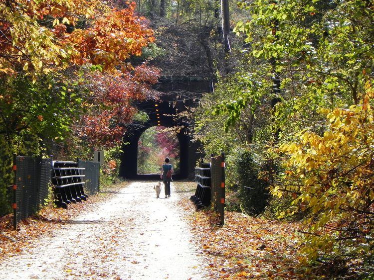
The paved portion of the trail begins south of Bethesda, where the trail begins to turn south. It follows the Little Falls Branch to the Potomac River and the District line. It goes over the River Road Bridge and past the site of Fort Sumner, a Civil War-era fort. It then moves through the Dalecarlia area, traveling under the Washington Aqueduct conduit at the Dalecarlia Tunnel, past the Dalecarlia Reservoir and through the grounds of the Dalecarlia Treatment Plant over the Dalecarlia Bridge.
Crossing into Washington, DC, it then turns southeast, dropping down from the Palisades neighborhood over the C&O Canal on the Arizona Avenue Railway Bridge, and down to the banks of the Potomac. It then runs between the Potomac and the C&O Canal, past Fletcher's Boathouse and the Foundry Branch Tunnel, into Georgetown to its terminus at the west end of Water Street NW.
The final segment of the CCT, from Lyttonsville to the Silver Spring, MD Metro Station, has yet to be built. Construction of this portion, and paving of the present Georgetown Branch Trail, is currently planned in conjunction with development of the Purple Line, a proposed rapid transit line.