
Maximum height above sea level 3.3 ft (1.0 m) Locks 1 | Status Open Date of first use 1 January 1965 | |
 | ||
Similar Dead River, Haulover Canal, Tampa Bypass Canal, Pottsburg Creek, Snapper Creek | ||
Cape canaveral barge canal west2east
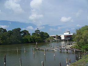
The Canaveral Barge Canal provides an east-to-west link between the Atlantic Ocean and Indian River Lagoon across northern Merritt Island, Florida, in two segments separated by the Banana River. It is located 15 miles south of Titusville, Florida. The canal is 12 feet deep and has entrances to other water systems including Syke's Creek and various marinas. The canal links Port Canaveral along the Atlantic Ocean to the Intracoastal Waterway running down the center of the Indian River Lagoon. The canal was constructed to allow the transport of crude oil by barge to the two power plants south of Titusville, Florida.
Contents
- Cape canaveral barge canal west2east
- Map of Canaveral Barge Canal Merritt Island FL 32953 USA
- References
Map of Canaveral Barge Canal, Merritt Island, FL 32953, USA
References
Canaveral Barge Canal Wikipedia(Text) CC BY-SA