
Basin area 310.8 km² | Basin size 120 sq mi (310 km) Length 6 km | |
 | ||
Main source Everglades7 ft (2.1 m) River mouth Matheson Hammock Park21 ft (6.4 m) Discharge Average rate:800 cu ft/s (23 m/s) Similar University Club Tower, Dead River, Canaveral Barge Canal, Tampa Bypass Canal, Pottsburg Creek | ||
Snapper creek 10001 fairchild way coral gables fl
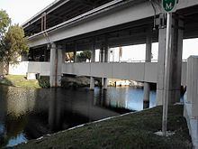
The Snapper Creek is a creek in the U.S. state of Florida that drains out of the Everglades into Biscayne Bay at Biscayne National Park. It is a 4-mile (6.4 km) long creek 15 miles (24 km) south of Downtown Miami, running through the suburbs of Kendall and Coral Gables in metropolitan Miami. The creek extends from Biscayne Bay inland to the Snapper Creek Canal, which extends 10 miles (16 km) further to the Everglades.
Contents
- Snapper creek 10001 fairchild way coral gables fl
- Kayaking snapper creek miami fl
- HistoryEdit
- References
Kayaking snapper creek miami fl
HistoryEdit
Originally shallow in depth, the westernmost parts of creek have since been dredged and the original river connected to a canal system. This effort was spearheaded as a part of flood mitigation efforts in the 1940s by the Florida State Board of Conservation, who lobbied for the creation of South Florida Water Management District in 1948. The flood protection system intensified after extensive flooding in South Florida following the 1947 Fort Lauderdale Hurricane and the population explosion in Greater Miami and subsequent urban sprawl following World War II.