
Country United States County Montgomery Area 111.7 km² Population 3,730 (2010) | State New York Time zone Eastern (EST) (UTC-5) Local time Tuesday 7:55 PM | |
 | ||
Weather 6°C, Wind E at 5 km/h, 98% Humidity Points of interest Arkell Museum, Van Alstyne Homeste, Wintergreen Park Road | ||
Canajoharie /ˌkænədʒoʊˈhæri/ is a town in Montgomery County, New York, United States. The population was 3,730 at the 2010 census. Canajoharie is located south of the Mohawk River on the south border of the county. The Erie Canal passes along the north town line. There is also a village of Canajoharie in the town. Both are east of Utica and west of Amsterdam.
Contents
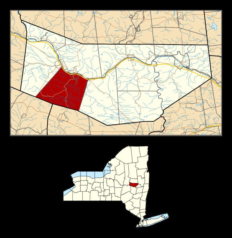
- Map of Canajoharie NY USA
- History
- Notable people
- Geography
- Demographics
- Communities and locations in the town
- References
Map of Canajoharie, NY, USA
These were settled as European-American jurisdictions, named for the historic Mohawk village of the same name, which was also known as the Mohawk Upper Castle.
History
The town is near the former site of Canajoharie, an important village of the Mohawk nation that also became known as the Upper Castle. The Mohawk had as their territory most of the central area of present-day New York from the Hudson River west to where Oneida territory started. They also used the St. Lawrence River valley as hunting grounds after 1600. They dominated the fur trade with the French based in central Quebec, and with Dutch and later English in eastern New York. French, Dutch and later English trappers and traders came to this Mohawk village to trade. Both the French and Dutch married or had unions with Mohawk women, increasing their ties with the people. Their mixed-race children married into the Dutch and later English communities. Many of their sons also became interpreters or traders.
Anglo-Europeans began settling in the area around 1730 and the Mohawk gradually adopted certain English customs in their village. Because the Mohawk and three other Iroquois nations were allied with the British during the Revolutionary War, they were forced to cede most of their lands in New York after the United States victory. The state sold millions of acres of land to speculators and private owners.
The town of Canajoharie was consumed by fire 3 times causing an ordinance to be passed prohibiting homes to be constructed of wood. Therefore, many of the older homes in the town are made of brick or locally quarried stone.
After the revolutionary war George Washington visited Canajoharie after surveying the damage to nearby Cherry Valley, NY. He stayed the night at the Van Alstyne home a common meeting place. The Van Alstyne house has long been referred to by some as Ft. Rensselaer), the actual Ft.Rensselaer (destroyed sometime before the French-Indian War) was in nearby Ft. Plain, NY.
The modern town was formed in 1788, but was reduced to form the towns of Minden (1798) and Root (in part, 1823). While the Mohawk Valley developed with the completion of the Erie Canal, the project also enabled considerable migration from New York to the Midwest. The population of the town in 1865 was 4,248.
Beech-Nut, the baby food producer, was founded in Canajoharie in 1891 during the period of early industrialization in the river valley. It served as the largest employer in the town for more than a century. In March 2011, the Beech-Nut factory moved out of Canajoharie, relocating to a new factory in the nearby town of Florida, near Amsterdam on the south side of the river, still in Montgomery County.
Notable people
Geography
According to the United States Census Bureau, the town has a total area of 43.1 square miles (111.7 km2), of which 42.6 square miles (110.4 km2) is land and 0.50 square miles (1.3 km2), or 1.16%, is water.
The south town line is the border of Schoharie County, and the north town line is defined by the Mohawk River.
The New York State Thruway crosses the northern part of the town, following the river. New York State Route 5S parallels the Thruway. New York State Route 10 is a north-south highway, intersecting the Thruway and NY-5S at Canajoharie village.
Demographics
As of the census of 2000, there were 3,797 people, 1,492 households, and 1,026 families residing in the town. The population density was 88.5 people per square mile (34.2/km²). There were 1,637 housing units at an average density of 38.2 per square mile (14.7/km²). The racial makeup of the town was 97.02% White, 0.63% Black or African American, 0.40% Native American, 0.50% Asian, 0.32% from other races, and 1.13% from two or more races. Hispanic or Latino of any race were 1.13% of the population.
There were 1,492 households out of which 33.2% had children under the age of 18 living with them, 53.0% were married couples living together, 11.3% had a female householder with no husband present, and 31.2% were non-families. 26.1% of all households were made up of individuals and 12.2% had someone living alone who was 65 years of age or older. The average household size was 2.52 and the average family size was 3.00.
In the town, the population was spread out with 26.3% under the age of 18, 7.5% from 18 to 24, 25.8% from 25 to 44, 23.7% from 45 to 64, and 16.8% who were 65 years of age or older. The median age was 39 years. For every 100 females there were 94.1 males. For every 100 females age 18 and over, there were 91.0 males.
The median income for a household in the town was $31,701, and the median income for a family was $39,646. Males had a median income of $29,107 versus $22,617 for females. The per capita income for the town was $16,702. About 11.0% of families and 11.3% of the population were below the poverty line, including 17.8% of those under age 18 and 3.3% of those age 65 or over.