
Elevation 93 m Population 2,181 (2013) | Zip code 13317 Local time Tuesday 7:54 PM | |
 | ||
Weather 6°C, Wind E at 5 km/h, 98% Humidity | ||
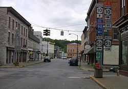
A trip south through canajoharie ny 2015
Canajoharie, also known as the "Upper Castle", was the name of one of two major towns of the Mohawk nation in 1738. The community stretched for a mile and a half along the southern bank of the Mohawk River, from a village known as Dekanohage eastward to what is now Fort Plain, New York.
Contents
Map of Canajoharie, NY, USA
The Upper Castle historic district has been designated as a National Historic Landmark and listed on the National Register of Historic Places. It contains the Indian Castle Church, built in 1769 for the Mohawk by Sir William Johnson, the British Superintendent of Indian Affairs, on land donated by his consort Molly Brant and her brother Joseph Brant, both leaders among the Mohawk. The site also has archeological resources related to Iroquois history. For a time the town was the home of the notable Mohawk leaders Hendrick Theyanoguin (1692–1755) and the Brants. According to Joseph Brant, Canajoharie means "a kettle stuck on a pole." A modern etymology translates it as "a washed kettle". It referred to actions of water from the Mohawk River in a portion of the Canajoharie Gorge.
The modern village of Canajoharie, New York was settled by European Americans a few miles to the east of the historic Mohawk village.