
Country United States Platted 1883 Elevation 415 m | State Kansas Time zone CST (UTC-6) Local time Tuesday 2:53 PM | |
 | ||
Weather 16°C, Wind W at 40 km/h, 10% Humidity | ||
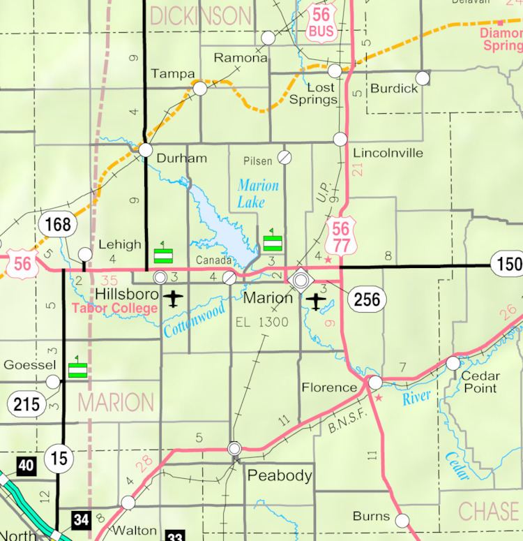
Canada is an unincorporated community in Marion County, Kansas, United States. It is named for many Canadian immigrants coming to the area.
Contents
- Map of Canada Gale KS 66861 USA
- Early history
- 19th century
- 20th century
- 21st century
- Geography
- Area attractions
- Primary and secondary education
- Transportation
- Utilities
- References
Map of Canada, Gale, KS 66861, USA
Early history
For many millennia, the Great Plains of North America was inhabited by nomadic Native Americans. From the 16th century to 18th century, the Kingdom of France claimed ownership of large parts of North America. In 1762, after the French and Indian War, France secretly ceded New France to Spain, per the Treaty of Fontainebleau.
19th century
In 1802, Spain returned most of the land to France. In 1803, most of the land for modern day Kansas was acquired by the United States from France as part of the 828,000 square mile Louisiana Purchase for 2.83 cents per acre.
In 1854, the Kansas Territory was organized, then in 1861 Kansas became the 34th U.S. state. In 1855, Marion County was established within the Kansas Territory, which included the land for modern day Canada.
David Christie, former Speaker of the Canadian Senate, sent his sons to buy 3 square miles (8 km2) near the future site of Canada. Many Canadian immigrants moved to the area, thus was the source of the community. Canada was platted on December 15, 1883, but never incorporated. Canada had a Post Office from 1884 to 1954.
As early as 1875, city leaders of Marion held a meeting to consider a branch railroad from Florence. In 1878, Atchison, Topeka and Santa Fe Railway and parties from Marion County and McPherson County chartered the Marion and McPherson Railway Company. In 1879, a branch line was built from Florence to McPherson, in 1880 it was extended to Lyons, in 1881 it was extended to Ellinwood. The line was leased and operated by the Atchison, Topeka and Santa Fe Railway. The line from Florence to Marion, was abandoned in 1968. In 1992, the line from Marion to McPherson was sold to Central Kansas Railway. In 1993, after heavy flood damage, the line from Marion through Canada to McPherson was abandoned and removed. The original branch line connected Florence, Marion, Canada, Hillsboro, Lehigh, Canton, Galva, McPherson, Conway, Windom, Little River, Mitchell, Lyons, Chase, Ellinwood.
A post office existed in Canada from February 20, 1884 to February 28, 1954.
20th century
From 1964 to 1968, the Marion Reservoir was constructed north of Canada.
21st century
In August 2015, a film crew for an advertising agency in Toronto, Ontario came to Canada to interview residents and give away New Balance shoes for a Canadian TV commercial.
Geography
Canada is located at 38°21′15″N 97°6′46″W (38.3541802, -97.1128030), approximately halfway between Marion and Hillsboro.
Area attractions
Primary and secondary education
Canada is part of Unified School District 408. The high school is a member of T.E.E.N., a shared video teaching network between five area high schools. All students attend schools in Marion.
Transportation
U.S. Route 56 highway is 0.5 miles (0.80 km) north of the community. U.S. 56 was previously located 0.5 miles (0.80 km) south of the community.