
Type Reservoir Area 24.93 km² Shore length 96.6 km | Surface elevation 411 m | |
 | ||
Primary inflows Primary outflows North Cottonwood River to Cottonwood River Catchment area 200 square miles (520 km) Managing agency | ||
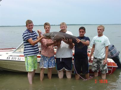
White bass and wipers at marion reservoir
Marion Reservoir is a body of water on the Cottonwood River, 3 miles (4.8 km) north-west of Marion, on the western edge of the Flint Hills region of Kansas in the United States. It was completed in 1968 and is operated by the Army Corps of Engineers for the purpose of flood control.
Contents
- White bass and wipers at marion reservoir
- Map of Marion Reservoir Kansas USA
- GeographyEdit
- Early historyEdit
- 19th centuryEdit
- 20th centuryEdit
- 21st centuryEdit
- Recreation areasEdit
- References
Map of Marion Reservoir, Kansas, USA
This larger reservoir is also known as its older obsolete name Marion Lake which is often confused with the similar named yet smaller Marion County Lake which is south-east of Marion. Most locals refer to the larger body of water using the term 'Reservoir' (this article), and the smaller body of water using the term 'Lake'.
GeographyEdit
Marion Reservoir is located in Gale Township of Marion County, Kansas, United States. There are many entrances into the reservoir area. A two-lane paved road runs along the top length of the dam. The south edge of the dam is located approximately 1/2 mile north of U.S. Route 56 on Old Mill Road, where there is an information kiosk and public restrooms. The unincorporated community of Eastshore is located north-east of the dam. The closest cities are Marion (east of reservoir) and Hillsboro (west of reservoir).
Early historyEdit
For many millennia, the Great Plains of North America was inhabited by nomadic Native Americans. From the 16th century to 18th century, the Kingdom of France claimed ownership of large parts of North America. In 1762, after the French and Indian War, France secretly ceded New France to Spain, per the Treaty of Fontainebleau.
19th centuryEdit
In 1802, Spain returned most of the land to France. In 1803, most of the land for modern day Kansas was acquired by the United States from France as part of the 828,000 square mile Louisiana Purchase for 2.83 cents per acre.
In 1806, Zebulon Pike led the Pike expedition westward from St Louis, Missouri, of which part of their journey followed the Cottonwood River through Marion County including the land under the Reservoir.
In 1854, the Kansas Territory was organized, then in 1861 Kansas became the 34th U.S. state. In 1855, Marion County was established within the Kansas Territory, which included the land for modern day Reservoir.
20th centuryEdit
In June and July 1951, the "Great Flood of 1951" occurred with a peak discharge of 54,000 cu ft/s (1,500 m3/s) and a volume of 78,950 acre feet (97,380,000 m3) which is equivalent to 7.40 inches (188 mm) of runoff from the drainage area above the dam site. The 1951 record flood in the region was one of the leading reasons for building the Marion Reservoir, and downstream leevee's in the cities of Marion and Florence.
In March 1964, construction was started on the Marion Reservoir, the embankment closure was completed in October 1967, and the project was placed in full flood control operation in February 1968.
21st centuryEdit
In 2011, the Cottonwood Point recreation area was expanded by adding 61 new campsites, 23 new day-use sites, picnic shelters, and a new beach.
Recreation areasEdit
Camping and picnicking opportunities are numerous in four parks: Cottonwood Point, Hillsboro Cove, Marion Cove, French Creek Cove. Campsites contain picnic tables, grills and/or fire-rings, sun-shelters, and gravel parking pads. Facilities at class "A" parks (Cottonwood Point and Hillsboro Cove) include electrical hookups, showers, RV dump stations, group camping areas, group picnic areas, playgrounds, and beaches. Potable water is available in all parks.