
Population 41,293 (2006 census) Time zone AEST (UTC+10:00) Postal code 4551 | Postcode(s) 4551 Local time Tuesday 12:03 PM | |
 | ||
Location 90 km (56 mi) from Brisbane Weather 27°C, Wind E at 14 km/h, 51% Humidity Points of interest Kings Beach - Queensland, Golden Beach - Queensland, Dicky Beach - Queensland, Pumicestone Passage, Australia Zoo | ||
Caloundra /kəˈlaʊndrə/ is the southernmost community on the Sunshine Coast in South East Queensland, Australia, located 90 kilometres (55.9 mi) north of Brisbane CBD. Caloundra is accessible from Landsborough railway station and the Caloundra bus station.
Contents
- Map of Caloundra QLD 4551 Australia
- History
- Heritage listings
- Geography
- Transport
- Population
- Tourism
- References
Map of Caloundra QLD 4551, Australia
History
In 1875, Robert Bulcock, an English immigrant who founded a Brisbane newspaper and later represented the Brisbane suburb of Enoggera in the Legislative Assembly of Queensland from 1885 until 1888, bought 277 acres (1.12 km2) of land in the region. A town was surveyed in the 1870s, and land sales commenced in 1883. With its proximity to beaches, the area became popular with tourists and a number of hotels and guest houses were set up to accommodate them.
In 1917, Bulcock's son, Robert Bulcock Jr, who was a councillor in the Shire of Landsborough, subdivided part of the land into 404 lots. This area became known as Bulcock Beach. By 1933, Caloundra had a population of 271.
During World War II, the area became key to Australian defence due to defensive positions along the beaches. Radar stations and machine gun pits were mounted, and Australian and US armed forces came to the area. From the early 1950s onwards, Caloundra experienced a boom in development and population, and by 1968, it had come to dominate the Shire of Landsborough so completely that the council chambers were relocated to Caloundra.
Heritage listings
Caloundra has a number of heritage-listed sites, including:
Geography
Caloundra is not strictly defined, but the boundary used by the Australian Bureau of Statistics for census purposes and the urban zone defined by the Sunshine Coast Regional Council (formerly the Caloundra City Council) almost exactly coincide. This region is bounded roughly by Currimundi Creek, Rainforest Drive and the Mooloolah River to the north, Beerwah State Forest and Bruce Highway to the west, the Pumicestone Passage (separating the area from Bribie Island) and the ocean to the east, and Bells Creek to the south. The central business district (CBD) for the area is located on Bulcock Street, Caloundra.
The Caloundra urban centre consists of the following suburbs:
Transport
The region of the Sunshine Coast, including Caloundra, is serviced by the Sunshine Coast Airport, located at Marcoola. A smaller regional airport is also located at Caloundra.
Caloundra's suburbs are served by Sunbus Sunshine Coast, who operate a bus interchange in Cooma Terrace in the CBD. Bus routes 600–609 connect Caloundra to Kawana Waters, Maroochydore, Buderim and Landsborough.
Landsborough railway station on the Nambour / Gympie North Line has regular services to Brisbane, operated by QR Citytrain. There are also coach services from Caloundra to Brisbane Airport.
Population
Census populations for the Caloundra urban centre have been recorded since 1933. Since the 2001 census, it is divided between the Caloundra North and Caloundra South statistical local areas. The drop between 1981 and 1986 reflects an adjustment of the boundary with the Kawana Waters urban centre.
Tourism
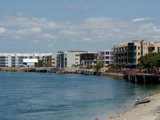
Caloundra has a variety of beaches, providing amenity to the local residents and tourists.