
Population 3,706 (2011 census) Postcode(s) 4550 State electorate(s) CaloundraGlass House Postal code 4550 | Established 1871 Founded 1871 Local time Sunday 8:03 PM | |
 | ||
Weather 26°C, Wind N at 16 km/h, 78% Humidity Points of interest Big Kart Track, Ewen Maddock Dam, Dularcha National Park, Pioneer Park, Skippy Park | ||
Man arrested over murder landsborough queensland 2010
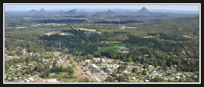
Landsborough is a small town on the Sunshine Coast hinterland of Queensland, Australia. It is situated north of the Glasshouse Mountains just off Steve Irwin Way, 82 kilometres (51 mi) north of Brisbane at the base of the southern end of the Blackall Range. At the 2011 census, Landsborough had a population of 3,706.
Contents
- Man arrested over murder landsborough queensland 2010
- Map of Landsborough QLD 4550 Australia
- History
- Education
- Heritage listings
- Features
- Museum
- Transport
- References
Map of Landsborough QLD 4550, Australia
Landsborough is situated on the North Coast railway line from Brisbane and there are several services daily southbound to Brisbane and northbound to Nambour and Gympie. It is one of the main rail/bus interchanges for TransLink bus services to the Sunshine Coast.
History
Landsborough was named for the British born explorer William Landsborough who was the first European to cross Australia north to south. The earliest European settlers arrived in the area in 1871. Originally called Mellum Creek ("mellum" is an Aboriginal word for "volcano"), it dates from 1871 when Isaac Burgess erected a slab hut with bark roof as "port of call" for Cobb and Co coaches stopping for refreshments and a change of horses.
Mellum Creek Post Office opened on 23 January 1881. It was renamed Landsborough in 1890.
In the past Landsborough was one of the larger towns of the Sunshine Coast having a large logging industry. In comparison, beachside Caloundra was a fishing village to its east, as opposed to the larger popular tourist destination it is today.
In 1912, the town became the administrative centre for the Landsborough Shire after separating from the Caboolture Shire. Landsborough Shire merged into the City of Caloundra in 1968.
The Landsborough School of Arts Memorial Hall was celebrated with a stump capping ceremony on 24 November 1923 involving Member of the Queensland Legislative Assembly for Murrumba, Richard Warren. The hall was officially opened on 4 May 1924 by Queensland Governor, Matthew Nathan.
Education
Landsborough State School opened in September 1879 and currently caters for students from Prep to Year six.
Heritage listings
Landsborough has a number of heritage-listed sites, including:
Features
Landsborough today is a popular tourism stop off due to the fact it is the first stop and is often regarded as the Gateway to the hinterland Tourist Trail. Landsborough today features parks and playgrounds, such as Pioneer park. There is a museum located in the former Landsborough Shire Council Chambers which contains a large number of historical artefacts from the local area. Landsborough's economy mostly derives from small businesses, with many cafés and small eateries.
Museum
The Landsborough Shire Museum houses artefacts from the pre-colonial and the early pioneer years from the area of the former Landsborough shire and the modern day Caloundra City region. Of note are the artefacts belonging to explorer William Landsborough.
Transport
The Landsborough railway station provides access to Brisbane, Nambour and Gympie via train and is the major bus transport hub for the coastal regions of the Sunshine Coast.