
Length 52.02 km | ||
 | ||
Existed: 1974 (from US 66) – present East end: | ||
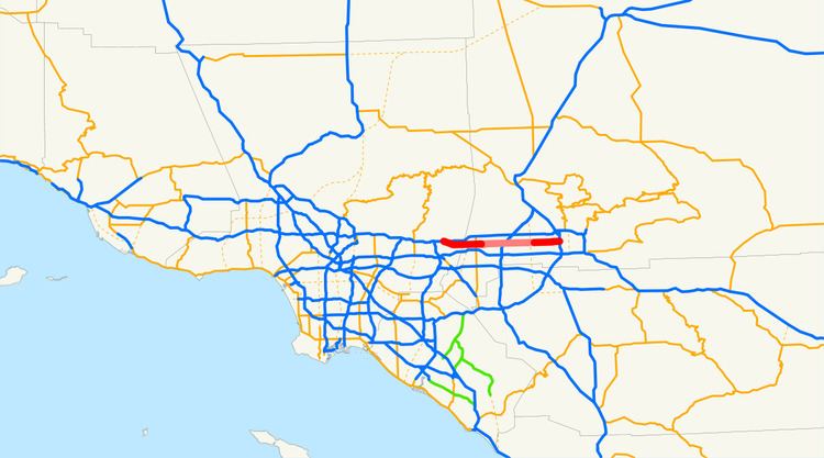
State Route 66 (SR 66) is a state highway in the U.S. state of California, running along the section of old U.S. Route 66 in California from La Verne east to San Bernardino, passing through Claremont, Upland, Rancho Cucamonga, Fontana and Rialto along Foothill Boulevard. In San Bernardino, it is the part of Fifth Street west of H Street (at the Interstate 215 interchange).
Contents
Route description
SR 66 is part of the California Freeway and Expressway System, although it is neither a freeway nor an expressway.
The route begins as Foothill Boulevard at the interchange with SR 210 in the city of La Verne. SR 66 heads southeast for a few miles before entering Pomona and turning due east. The highway continues into the city of Claremont, passing by Claremont Colleges, before crossing into Upland, San Bernardino County.
In Upland, SR 66 passes by Cable Airport to the south, continuing due east. The highway intersects SR 83 before entering Rancho Cucamonga, where state maintenance of SR 66 currently ends. Foothill Boulevard continues east through Rancho Cucamonga through an interchange with I-15 before entering Fontana, and passing well north of the California Speedway. Foothill Boulevard continues east into Rialto, where the SR 66 designation resumes. SR 66 continues east into San Bernardino, before curving to the north as 5th Street and terminating at I-215 south of downtown.
California's legislature has relinquished state control of the segment from the Pomona–Claremont line east to the Fontana–Rialto line, and turned it over to local control.
History
As a state route, SR 66 was added to the state highway system in the 1964 state highway renumbering, from SR 30 around San Dimas to San Bernardino. By 2013, the portion from east of Pomona to the eastern boundary of Rialto had been relinquished to the various cities that the route passed through.
Major intersections
Except where prefixed with a letter, postmiles were measured on the road as it was in 1964, based on the alignment that existed at the time, and do not necessarily reflect current mileage. R reflects a realignment in the route since then, M indicates a second realignment, L refers an overlap due to a correction or change, and T indicates postmiles classified as temporary (for a full list of prefixes, see the list of postmile definitions). Segments that remain unconstructed or have been relinquished to local control may be omitted. The numbers reset at county lines; the start and end postmiles in each county are given in the county column.