
Length 20.42 km | ||
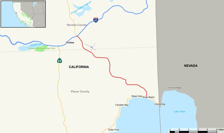 | ||
State Route 267, known as North Shore Boulevard, is a California state highway near Lake Tahoe, United States. It connects Interstate 80 in Truckee to the Northstar at Tahoe ski resort and Kings Beach on Lake Tahoe, and serves as an alternate route to Route 89 for connecting between Interstate 80 and Route 28 on Lake Tahoe's shoreline at the Nevada border.
Contents
Map of CA-267, California, USA
Route description
The route begins at Interstate 80 in Truckee with and interchange. It then continues through Nevada County until it reaches the county line. In Placer County, it meets its east end at SR 28 in Kings Beach.
Major intersections
Except where prefixed with a letter, postmiles were measured on the road as it was in 1964, based on the alignment that existed at the time, and do not necessarily reflect current mileage. R reflects a realignment in the route since then, M indicates a second realignment, L refers an overlap due to a correction or change, and T indicates postmiles classified as temporary (for a full list of prefixes, see the list of postmile definitions). Segments that remain unconstructed or have been relinquished to local control may be omitted. The numbers reset at county lines; the start and end postmiles in each county are given in the county column.