
Country United States County Placer FIPS code 06-38548 Elevation 1,905 m Zip code 96143 Area code Area code 530 | Time zone PST (UTC-8) GNIS feature ID 1662302 Area 8.907 km² Population 3,796 (2010) | |
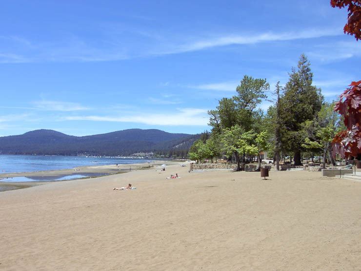 | ||
Kings Beach is a census-designated place (CDP) in Placer County, California, United States on the north shore of Lake Tahoe. It is part of the Sacramento–Arden-Arcade–Roseville Metropolitan Statistical Area. The population was 3,796 at the 2010 census, down from 4,037 at the 2000 census.
Contents
Map of Kings Beach, CA, USA
The town's post office was erected in 1937. It was shut down between the years of 1942-1945. The area's name is after the first postmaster, Joe King.
Geography
Kings Beach is located at 39°14′28″N 120°1′24″W (39.241170, -120.023295).
According to the United States Census Bureau, the CDP has a total area of 3.4 square miles (8.8 km2), all of it land.
California State Route 28 passes through Kings Beach along the Lake Tahoe shore. California State Route 267 meets Route 28 in Kings Beach and connects the town to Northstar, Truckee, and Interstate 80.
Climate
Kings Beach has a warm-summer Mediterranean climate (Köppen climate classification Csb) that is characterized by warm (but not hot) dry summers, and snowy winters. Due to its high elevation Kings Beach winters tend to fall below freezing for many days during the winter.
2010
The 2010 United States Census reported that Kings Beach had a population of 3,796. The population density was 1,103.7 people per square mile (426.2/km²). The racial makeup of Kings Beach was 3,216 (84.7%) White, 15 (0.4%) African American, 20 (0.5%) Native American, 14 (0.4%) Asian, 2 (0.1%) Pacific Islander, 409 (10.8%) from other races, and 120 (3.2%) from two or more races. Hispanic or Latino of any race were 2,115 persons (55.7%).
The Census reported that 3,717 people (97.9% of the population) lived in households, 79 (2.1%) lived in non-institutionalized group quarters, and 0 (0%) were institutionalized.
There were 1,362 households, out of which 487 (35.8%) had children under the age of 18 living in them, 589 (43.2%) were opposite-sex married couples living together, 106 (7.8%) had a female householder with no husband present, 81 (5.9%) had a male householder with no wife present. There were 134 (9.8%) unmarried opposite-sex partnerships, and 6 (0.4%) same-sex married couples or partnerships. 381 households (28.0%) were made up of individuals and 72 (5.3%) had someone living alone who was 65 years of age or older. The average household size was 2.73. There were 776 families (57.0% of all households); the average family size was 3.44.
The population was spread out with 924 people (24.3%) under the age of 18, 400 people (10.5%) aged 18 to 24, 1,405 people (37.0%) aged 25 to 44, 842 people (22.2%) aged 45 to 64, and 225 people (5.9%) who were 65 years of age or older. The median age was 31.6 years. For every 100 females there were 125.3 males. For every 100 females age 18 and over, there were 129.8 males.
There were 2,372 housing units at an average density of 689.7 per square mile (266.3/km²), of which 552 (40.5%) were owner-occupied, and 810 (59.5%) were occupied by renters. The homeowner vacancy rate was 5.3%; the rental vacancy rate was 14.4%. 1,379 people (36.3% of the population) lived in owner-occupied housing units and 2,338 people (61.6%) lived in rental housing units.
2000
As of the census of 2000, there were 4,037 people, 1,411 households, and 788 families residing in the CDP. The population density was 1,176.4 inhabitants per square mile (454.4/km²). There were 2,284 housing units at an average density of 665.6 per square mile (257.1/km²). The racial makeup of the CDP was 70.03% White, 0.72% Black or African American, 1.88% Native American, 0.40% Asian, 0.02% Pacific Islander, 23.61% from other races, and 3.34% from two or more races. 48.43% of the population were Hispanic or Latino of any race.
There were 1,411 households out of which 34.8% had children under the age of 18 living with them, 39.4% were married couples living together, 8.9% had a female householder with no husband present, and 44.1% were non-families. 28.3% of all households were made up of individuals and 3.0% had someone living alone who was 65 years of age or older. The average household size was 2.86 and the average family size was 3.69.
In the CDP, the population was spread out with 28.0% under the age of 18, 13.3% from 18 to 24, 38.0% from 25 to 44, 17.4% from 45 to 64, and 3.4% who were 65 years of age or older. The median age was 29 years. For every 100 females there were 122.9 males. For every 100 females age 18 and over, there were 133.2 males.
The median income for a household in the CDP was $35,507, and the median income for a family was $37,837. Males had a median income of $25,880 versus $21,571 for females. The per capita income for the CDP was $16,556. About 17.1% of families and 17.7% of the population were below the poverty line, including 20.3% of those under age 18 and 4.1% of those age 65 or over.
Beaver Controversy
In November, 2009 non-native California Golden beavers were caught in snares underwater and exterminated in Griff Creek, a stream in King's Beach, California when Placer County Department of Public Works ordered their removal for fear that the beaver would cause flooding. Although an invasive species to the area, recent studies of two other Lake Tahoe tributaries, Taylor Creek and Ward Creek, showed that beaver dam removal decreased wetland habitat, increased stream flow, and increased total phosphorus pollutants entering Lake Tahoe - all factors which negatively impact the clarity of the lake's water.(United States Geological Survey 2002) Beavers develop wetland areas which trap sediments and improve water quality. Flow devices such as "Beaver Deceivers" are often used to control water heights in beaver ponds instead of killing beavers, as the latter is typically only a temporary remedy, for beavers recolonize prime habitat quickly. In fact, in October 2010 Placer County officials again exterminated non-native beavers at King's Beach only to have schoolchildren protest and suggest more contemporary management solutions. According to Placer County officials there were four beavers who built three dams on Griff Creek, and they were killed by sharpshooters licensed by the county in a night operation. The Tahoe Regional Planning Agency stated that "removing beavers is not uncommon at Lake Tahoe" but "aid the county could have “easily” removed the beaver dam in a more conscientious manner, thus preventing sediment naturally filtered by the dam from reaching Lake Tahoe". Cheryl Millham, executive director of Lake Tahoe Wildlife Care, argued that the culverts on Griff Creek could easily be protected from damming with fencing and that "municipalities all over the United States have learned to peacefully co-exist with these animals". Depredation is likely a temporary solution as the County has had to kill beaver families two years in a row and Peter Kraatz, deputy director of the Placer County Department of Public Works, conceded that the area is "perfect habitat for beavers".