
Existed: 1933 – present East end: SR 245 at Elderwood Constructed 1933 | Length 40.7 km | |
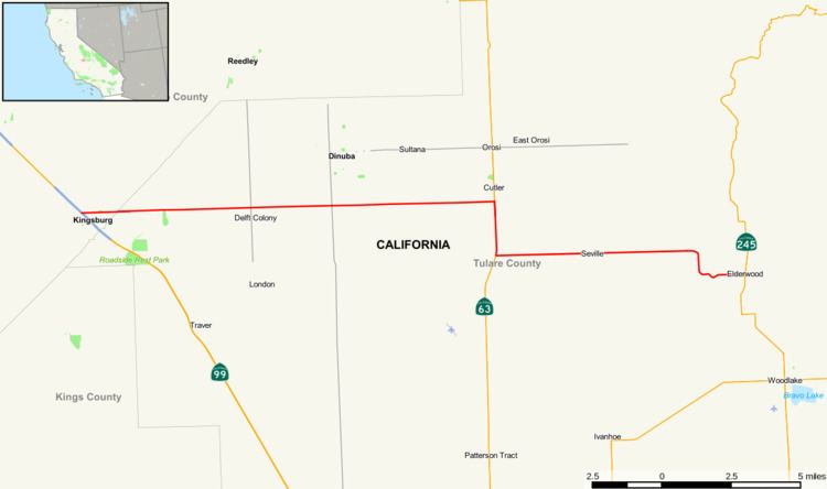 | ||
State Route 201 is a state highway in the Central Valley of California, United States. It connects Route 99 in Kingsburg with Route 245. Route 63 bridges a discontinuity in the middle of the route.
Contents
Map of CA-201, California, USA
Route description
The route begins at State Route 99 in Kingsburg, Fresno County with an interchange. It then exits the county and enters Tulare County, where it meets County Route J31 and County Route J19. It then meets State Route 63 for a short concurrency. Upon leaving, it intersects County Route J15 and County Route J23 before meeting its east end at State Route 245 in Elderwood.
Major intersections
Except where prefixed with a letter, postmiles were measured on the road as it was in 1964, based on the alignment that existed at the time, and do not necessarily reflect current mileage. R reflects a realignment in the route since then, M indicates a second realignment, L refers an overlap due to a correction or change, and T indicates postmiles classified as temporary (for a full list of prefixes, see the list of postmile definitions). Segments that remain unconstructed or have been relinquished to local control may be omitted. The numbers reset at county lines; the start and end postmiles in each county are given in the county column.