
Existed: 1972 – present Constructed 1972 | Length 67.6 km | |
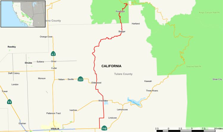 | ||
State Route 245 is a north–south highway that runs from near Exeter to near Kings Canyon National Park, connecting State Route 198 in Tulare County to State Route 180 in Fresno County. It runs through the city of Woodlake and the small unincorporated towns of Elderwood, Badger, and Pinehurst. Roughly 95% of its 42-mile (68 km) length traverses rural areas. It was formerly numbered State Route 69. North of Avenue 364 (Tulare County), State Route 245 is synonymous with Millwood Drive.
Contents
Map of CA-245, California, USA
Route description
The route begins at State Route 198 amid Tulare County. It then heads north and intersects State Route 216 in Woodlake and County Route J27 amid farmland in the county. The route continues to meet State Route 201 in Elderwood. After several miles through Tulare County, it crosses into Fresno County, where it meets its north end at State Route 180.
History
The route was defined in 1963 from Interstate 5 to SR 60 in the Los Angeles area. This route was deleted in 1965 and was replaced the former deleted State Route 69 in 1972.
Major intersections
Except where prefixed with a letter, postmiles were measured on the road as it was in 1964, based on the alignment of State Route 69 as it existed at that time, and do not necessarily reflect current mileage. R reflects a realignment in the route since then, M indicates a second realignment, L refers an overlap due to a correction or change, and T indicates postmiles classified as temporary (for a full list of prefixes, see the list of postmile definitions). Segments that remain unconstructed or have been relinquished to local control may be omitted. The numbers reset at county lines; the start and end postmiles in each county are given in the county column.