
Length 20.92 km | ||
 | ||
West end: Pinnacles National Park east boundary | ||
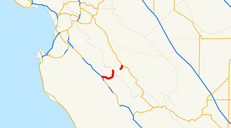
State Route 146 (SR 146) is a state highway in the U.S. state of California in Monterey and San Benito Counties. The route serves as an entryway to the Pinnacles National Park, located in the Gabilan Mountains, from both the Salinas Valley on the west and State Route 25 on the east.
Contents
Map of CA-146, California, USA
This route is eligible for the State Scenic Highway System.
Route description
Route 146 is divided into two sections and does not provide a continuous vehicular route through the park. The western part of Route 146 passes from U.S. Route 101 near Soledad along Metz Road and Shirttail Canyon Road to the west area of Pinnacles. The eastern portion runs into the east area of Pinnacles from Route 25 along Pinnacles Road.
Highway 146 has the distinction of following the San Andreas Fault line for much of its length. As it does, it straddles two separate landmasses: the Pacific Plate and the North American Plate.
History
According to the National Park Service, Pinnacles has been administered as a wilderness area as long as that unit has been under their jurisdiction, and NPS sources contacted during research cannot recall any time when Route 146 proceeded through the park unbroken.
Major intersections
Except where prefixed with a letter, postmiles were measured on the road as it was in 1964, based on the alignment that existed at the time, and do not necessarily reflect current mileage. R reflects a realignment in the route since then, M indicates a second realignment, L refers an overlap due to a correction or change, and T indicates postmiles classified as temporary (for a full list of prefixes, see the list of postmile definitions). Segments that remain unconstructed or have been relinquished to local control may be omitted. The numbers reset at county lines; the start and end postmiles in each county are given in the county column.