
Region MIMAROPA | ||
 | ||
Major islands Busuanga IslandCoron IslandCulion IslandCalauit Islandseveral other islets Points of interest Calamianes Expeditions & Ecotours Islands Similar Coron Island, Calauit Safari Park, Tubbataha Reef, Siargao, Pamalican | ||
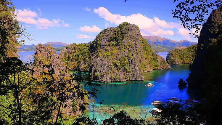
Pride of calamian islands culion coron palawan philippines
The Calamian Islands or Calamianes is a group of islands in the Philippine province of Palawan. It includes:
Contents
- Pride of calamian islands culion coron palawan philippines
- Map of Calamian Islands Philippines
- Island hopping in paradise coron philippines
- History
- References
Map of Calamian Islands, Philippines
Island hopping in paradise coron philippines
History
Historically, the Calamianes was site of the Spanish politico-militar Provincia de Calamianes. The Spanish Empire later purchased mainland Paragua from the Sultan of Borneo. During the American occupation (1898-1948), the old Provincia de Calamianes was dissolved and jointly administered with the Island of Paragua as the new Province of Palawan.
During the American occupation and up until recently, Culion Island was host to a leper colony. Busuanga Island hosts the largest town, Coron, in the Calamian Islands. Coron Island is known for having the cleanest inland body of water in the Philippines, called Kayangan Lake. Calauit Island is known for hosting a number of endangered African animal species. Diving spots, with coral reefs and sunken World War II Japanese shipwrecks, also lies within the waters of these islands.