
Elevation 1,151 m | ||
 | ||
Similar Summit Inn, Silverwood Lake, Tejon Pass, Tehachapi Loop, San Bernardino National | ||
Bnsf and union pacific on the cajon pass
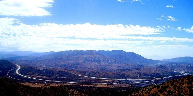
Cajon Pass (/kəˈhoʊn/; elevation 3,777 ft (1,151 m)) is a mountain pass between the San Bernardino Mountains and the San Gabriel Mountains in Southern California in the United States. It was created by the movements of the San Andreas fault. Located in the Mojave Desert, the pass is an important link from the Greater San Bernardino Area to the Victor Valley, and northeast to Las Vegas.
Contents
- Bnsf and union pacific on the cajon pass
- Map of Cajon Pass California 92371 USA
- Fire truck falls off i 15 freeway in the cajon pass
- Name
- Aviation
- Traffic
- Incidents
- Passenger service
- Road transport
- Pacific Crest Trail
- Utilities infrastructure
- Natural hazards
- References
Map of Cajon Pass, California 92371, USA
Cajon Pass is at the head of Horsethief Canyon, traversed by California State Route 138 (SR 138) and railroad tracks owned by BNSF Railway and Union Pacific Railroad. Railroad improvements in 1972 reduced its maximum elevation from about 3,829 feet (1,167 m) to 3,777 feet (1,151 m) while also reducing the curvature. Interstate 15 does not traverse Cajon Pass, but rather the nearby Cajon Summit, 34°20′58″N 117°26′47″W, elevation 4,190 feet (1,280 m). However, the entire area including Cajon Pass and Cajon Summit is often collectively called Cajon Pass. Sometimes the entire area is called Cajon Pass, but a distinction is made between Cajon Pass and Cajon Summit in detail.
In 1851, a group of Mormon settlers led by Amasa M. Lyman and Charles C. Rich traveled through the Cajon Pass in covered wagons on their way from Salt Lake City to southern California. A prominent rock formation in the pass, where the Mormon trail and the railway merge (at 34.3184°N 117.4920°W / 34.3184; -117.4920, near Sullivan's Curve), is known as Mormon Rocks.
Fire truck falls off i 15 freeway in the cajon pass
Name
In Spanish, the word cajón refers to a box or drawer. The name of the pass is derived from the Spanish land grant that encompassed the area; it was first referred to in English on a 1852 map.
Aviation
The Cajon Pass area is known for high wind, turbulence and fog. The weather over the pass can vary, from foggy days with poor visibility to clear afternoons where aircraft are bounced by gusting Santa Ana winds that top 80 mph (130 km/h). The wind in this area is predominantly out of the west, although in Santa Ana and other weather conditions it may be out of the north or the southeast. Air spilling over the San Gabriels can cause fairly violent up- and downdrafts. On a normal day, with the wind out of the west, turbulence usually starts a few miles west of Rialto and continues a few miles to the east, growing in strength above the altitude of the mountains and especially over the pass near the HITOP intersection. In Santa Ana conditions, up- and downdrafts can become especially violent northeast of Ontario Airport, and turbulence can be experienced all the way east to the Banning Pass, well known for turbulence. It's important to note that the mass and wing loading of an aircraft determines its sensitivity to turbulence, so what may seem violent in a Cessna 172 may seem only mild to moderate in a Boeing 747. In the 2006 Mercy Air 2 accident, an air ambulance helicopter collided with mountainous terrain near the pass in foggy weather.
Traffic
The California Southern Railroad, a subsidiary of the Atchison, Topeka and Santa Fe Railway, was the first railroad to use the Cajon Pass as a route through the mountains. The rail line through the pass was built in the early 1880s as part of a connection between the present day cities of Barstow and San Diego. Today the Union Pacific Railroad and BNSF Railway (the successor to the Santa Fe) use the pass to reach Los Angeles and San Bernardino. Due to the many trains, noteworthy scenery and easy access, it is a popular location for railfans, and numerous photographs of trains on Cajon Pass appear in books and magazines about trains.
The Union Pacific Railroad operates and owns one track through the pass, on the previous Southern Pacific Railroad Palmdale cutoff, opened in 1967. The BNSF Railway had two tracks and began to operate a third main track in the summer of 2008. The railroads share track rights through the pass ever since the Union Pacific gained track rights on the Santa Fe portion negotiated under the original Los Angeles and Salt Lake Railroad. The original BNSF (ATSF) line was constructed in the 1880s and later roads, U.S. Route 66 and I-15, roughly followed this route. The 3.0% grade for a few miles on the south track is challenging for long trains, making the westbound descent potentially dangerous, as a runaway can occur if the engineer is not careful in handling the brakes. The second track, built in 1913, is 2 miles (3.2 km) longer to get a lower 2.20% grade. It ran through two short tunnels, but both were removed when the third main track was added next to the 1913 line. Trains may be seen traveling at speeds of 60 and 70 mph (97 and 113 km/h) on the straighter track away from the pass, but typically ascend at 14 to 22 mph (23 to 35 km/h) and descend at 20 to 30 mph (32 to 48 km/h). The third track enables a capacity of 150 trains per day on the BNSF lines.
Incidents
Passenger service
In the past, Amtrak's Desert Wind, which ceased operation in 1997, used the pass. Currently, the Southwest Chief, makes a daily run in each direction between Chicago and Los Angeles, through Cajon Pass on the BNSF line.
Road transport
The Mojave Freeway (I-15) was built in 1969 over the Cajon Summit west of the Cajon Pass. It is a major route from Los Angeles and the Inland Empire to Las Vegas. The freeway runs above and parallel to an original stretch of historic Route 66 and U.S. Route 395. This stretch, now known as Cajon Boulevard, is a short, well-preserved fragment dating to a rerouting and widening of the highway in the early 1950s. Only the southbound/westbound lanes are in use; the northbound/eastbound lanes and corresponding bridges are closed to through traffic. It is along this stretch of road, accessible via either the Kenwood Drive or Cleghorn Road exits that some of the best aforementioned trainspotting areas may be found.
The historic Summit Inn, off the Oak Hills exit at the summit of the pass, was a historic Route 66 diner and was in the same location from 1952 to 2016, when it was destroyed by the Blue Cut fire. Some maps may show the Cajon Pass as a feature on SR 138, which crosses I-15 south of the summit between West Cajon Valley and Summit Valley. The highest point on I-15 between Los Angeles and Victorville is thus sometimes identified as Cajon Summit. However, the entire area, including Cajon Summit, is often called Cajon Pass.
Pacific Crest Trail
The Pacific Crest Trail goes directly through Cajon Pass, and during the hiking season up to several hundred transient hikers will pass through this area after walking one of the hottest, driest, and most grueling sections of desert on the trail. The McDonald's restaurant at the pass happens to be very close to the trail, and it is famous among hikers, who often arrive dehydrated; most will stop here for water and salty food. Many hikers also spend the night in the one motel at Cajon Pass.
Utilities infrastructure
In addition to transportation infrastructure, three high voltage Southern California Edison 500 kV power lines cross the summit as well. These power lines head to the Lugo substation northeast of Cajon Pass and connect to Path 26 and Path 46. Both Path 26 and 46 provide the Los Angeles metro area another source of electricity generated from fossil fuel power plants in the Four Corners region, and hydroelectric dams along the Colorado River.
Natural hazards
During October and November 2003, a number of wildfires devastated the hills and mountainsides near and around the pass, forcing the closure of Interstate 15. The following winter, rains in addition to burnt vegetation caused a number of landsides to further close the freeway pass.
On July 17, 2015, during severe drought conditions plaguing the whole state and creating extreme fire hazards, a fast, wind-whipped wildfire swept over Interstate 15 between California State Route 138 and the Oak Hill Road exits, sending drivers running for safety and setting 20 vehicles ablaze, officials said. The vegetation fire, which closed the I-15 southbound lanes and restricted the northbound side to 1 lane, overtook stalled cars.
The following year, the Blue Cut Fire again forced the closure of the freeway for several days starting on August 16, 2016. The fire closed the I-15 north and southbound lanes due to the intensity of the fire. It destroyed a number of outbuildings and homes, and destroyed the Summit Inn Restaurant in Oak Hills. A McDonald's restaurant was also burned but the damage was minor. The fire threatened homes in Lytle Creek, Phelan, Oak Hills and Wrightwood and burned 37,000 acres
In addition to wildfire hazards, Cajon Pass is notorious for wind hazards. In gusty conditions it is especially difficult to navigate through it as the Santa Ana winds usually push through that area. The winds sometimes reach gale-force strength. As a result, there are usually high wind advisories as well as road signs posted throughout the area. It is not uncommon to see overturned trucks during such windy weather there.
Cajon Pass gets snow occasionally, sometimes enough to close the pass temporarily. When there is snow, the California Highway Patrol will set up checkpoints on the freeway. Since most southern Californians are without snow tires or snow chains, they are forced to turn back, or wait until the snow has stopped and the freeway has been cleared of snow.
When there is high wind or snow in the Cajon Pass, it is fairly common for weather forecasters or reporters for San Bernardino, San Diego, and Los Angeles-area televisions stations to do location reports from the Cajon Pass.
The San Andreas Fault passes through the Cajon Pass (crossing I-15 on the south side of the summit) and is responsible for the unique local geography.