
Population 289 (2011) Sovereign state United Kingdom Area 6.55 km² Dialling code 01508 | OS grid reference TG235039 Post town NORWICH Local time Monday 7:08 AM | |
 | ||
Weather 5°C, Wind W at 16 km/h, 93% Humidity | ||
Caistor St Edmund is a village on the River Tas, near Norwich, Norfolk, England. It covers an area of 6.55 square kilometres (2.53 sq mi) and had a population of 270 in 116 households at the 2001 census, the population increasing to 289 at the 2011 Census.
Contents
Map of Caistor St. Edmund, UK
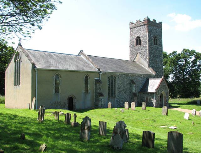
The remains of a Roman market town and capital of the Iceni tribe, Venta Icenorum, are nearby (British National Grid ref TG230034). The ruins are in the care of the Norfolk Archaeological Trust and managed by South Norfolk Council. It is assumed that the Roman 'Stone Street' runs from Dunwich on the Suffolk coast to Caistor St Edmund near Norwich. The parish church of St Edmund's lies at the south-east corner of the old Roman town. Caistor St Edmund features on the Antonine Itinerary, a Roman "road map" of the routes around Britain.
Caistor Old Hall was built in 1612 for Thomas Pettus. During the 19th century it was owned by John Spurrell (son of William Spurrell, of Thurgarton, Norfolk). The River Tas passes under Markshall bridge, just north of the Roman camp, and then flows on towards Arminghall and Trowse.
In Fiction
English comedic character Alan Partridge was married in the church.