
Area 1,116 km² Population 12,793 (2013) | Founded 1810 Unemployment rate 5.2% (Apr 2015) | |
 | ||
Website www.butlercounty.ky.gov Rivers Green River, Barren River, Mud River, Indian Camp Creek | ||
Butler County is a county located in the US state of Kentucky. As of the 2010 census, the population was 12,690. Its county seat is Morgantown. The county was formed in 1810, becoming Kentucky's 53rd county. It is a prohibition, or "dry", county.
Contents
- Map of Butler County KY USA
- History
- Geography
- Adjacent counties
- Demographics
- Transportation
- Radio stations
- Newspaper
- Communities
- Sites and events of interest
- Notable people
- References
Map of Butler County, KY, USA
Butler County is included in the Bowling Green, KY Metropolitan Statistical Area.
History
Numerous archaeological sites are located along the Green River in Butler County. A 1932 survey found nine sites, many of which were a group of shell mounds, including the Carlston Annis and DeWeese Shell Mounds.
The area now known as Butler County was first settled by the families of Richard C. Dellium and James Forgy, who founded a town called Berry's Lick. The first industry was salt-making.
On January 18, 1810, the Kentucky General Assembly created Butler County from portions of Logan and Ohio counties. The new county was named for Major General Richard Butler, who died at the Battle of the Wabash in 1791.
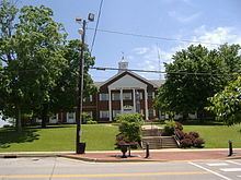
Butler County has one of only two Civil War monuments in Kentucky that honor the soldiers of both sides. The Confederate-Union Veterans' Monument in Morgantown, a zinc monument, was dedicated in 1907 on the Butler County Courthouse lawn.
Geography
According to the U.S. Census Bureau, the county has a total area of 431 square miles (1,120 km2), of which 426 square miles (1,100 km2) is land and 5.4 square miles (14 km2) (1.2%) is water. It is part of the Western Coal Fields region of Kentucky.
Adjacent counties
Demographics
As of the census of 2000, there were 13,010 people, 5,059 households, and 3,708 families residing in the county. The population density was 30 per square mile (12/km2). There were 5,815 housing units at an average density of 14 per square mile (5.4/km2). The racial makeup of the county was 97.88% White, 0.52% Black or African American, 0.22% Native American, 0.17% Asian, 0.60% from other races, and 0.61% from two or more races. 1.04% of the population were Hispanic or Latino of any race.
There were 5,059 households out of which 34.40% had children under the age of 18 living with them, 60.30% were married couples living together, 9.30% had a female householder with no husband present, and 26.70% were non-families. 23.70% of all households were made up of individuals and 10.30% had someone living alone who was 65 years of age or older. The average household size was 2.52 and the average family size was 2.98.
In the county, the population was spread out with 25.30% under the age of 18, 9.50% from 18 to 24, 29.20% from 25 to 44, 23.20% from 45 to 64, and 12.80% who were 65 years of age or older. The median age was 36 years. For every 100 females there were 99.00 males. For every 100 females age 18 and over, there were 96.20 males.
The median income for a household in the county was $29,405, and the median income for a family was $35,317. Males had a median income of $26,449 versus $19,894 for females. The per capita income for the county was $14,617. About 13.10% of families and 16.00% of the population were below the poverty line, including 18.50% of those under age 18 and 22.50% of those age 65 or over.
Transportation
For much of its history, Butler County's main line of transportation was the Green River. As railroads became more important economically, the county compensated by building a series of roads to major trade centers such as U.S. 231 connecting Beaver Dam with Owensboro. Green River was eventually closed to traffic after Woodbury's Lock and Dam Number 4 washed out in 1965 and Rochester's Lock and Dam Number 3 was abandoned by the United States Army Corps of Engineers in 1980. Completion of the William H. Natcher Parkway linked the area to the national interstate system in 1970.
Radio stations
Newspaper
Communities
Sites and events of interest
Sites include:
Events include: