
Congressional district 1st Area 1,544 km² Population 23,988 (2013) Unemployment rate 5.5% (Apr 2015) | Founded 1799 | |
 | ||
Website ohiocounty.ky.gov/Pages/default.aspx Rivers Green River, Rough River, Caney Creek, Adams Fork | ||
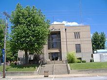
Ohio County is a county located in the U.S. state of Kentucky. As of the 2010 census, the population was 23,842. Its county seat is Hartford. The county is named after the Ohio River, which originally formed its northern boundary. It is a dry county, which means that the sale of alcohol is restricted or prohibited.
Contents
- Map of Ohio County KY USA
- History
- Geography
- Adjacent counties
- Demographics
- Census designated place
- Notable residents
- References
Map of Ohio County, KY, USA
History
Ohio County was formed in 1798 from land taken from Hardin County. Ohio was the 35th Kentucky county in order of formation. It was named for the Ohio River, which originally formed its northern boundary, but it lost its northern portions in 1829, when Daviess County and Hancock County were formed. The first settlements in Ohio County were Barnetts Station and Hartford. In January 1865, during the American Civil War, the courthouse in Hartford was burned by Kentucky Confederate cavalry because it was being used to house soldiers of the occupying Union Army. However, the county records were removed first and preserved. Ohio County is famous for its coal mines, which in the 1970s produced much of the nation's coal.
Geography
According to the U.S. Census Bureau, the county has a total area of 596 square miles (1,540 km2), of which 587 square miles (1,520 km2) is land and 9.0 square miles (23 km2) (1.5%) is water. It is the fifth-largest county by area in Kentucky.
Ohio County is part of the Western Coal Fields region of Kentucky. Much of Ohio County is farmland and the eastern and northern parts have rolling hills. Of the 120 counties in Kentucky, it is the fifth largest. The county is intersected by the Rough River and the Green River runs along its southwestern border.
Adjacent counties
Demographics
As of the census of 2000, there were 22,916 people, 8,899 households, and 6,585 families residing in the county. The population density was 39 per square mile (15/km2). There were 9,909 housing units at an average density of 17 per square mile (6.6/km2). The racial makeup of the county was 97.71% White, 0.75% Black or African American, 0.19% Native American, 0.20% Asian, 0.03% Pacific Islander, 0.45% from other races, and 0.67% from two or more races. 1.01% of the population were Hispanic or Latino of any race.
There were 8,899 households out of which 33.00% had children under the age of 18 living with them, 61.20% were married couples living together, 9.20% had a female householder with no husband present, and 26.00% were non-families. 23.20% of all households were made up of individuals and 11.10% had someone living alone who was 65 years of age or older. The average household size was 2.54 and the average family size was 2.98.
In the county, the population was spread out with 24.90% under the age of 18, 8.60% from 18 to 24, 27.50% from 25 to 44, 24.60% from 45 to 64, and 14.40% who were 65 years of age or older. The median age was 38 years. For every 100 females there were 96.60 males. For every 100 females age 18 and over, there were 94.20 males.
The median income for a household in the county was $29,557, and the median income for a family was $34,970. Males had a median income of $29,778 versus $19,233 for females. The per capita income for the county was $15,317. About 13.90% of families and 17.30% of the population were below the poverty line, including 21.90% of those under age 18 and 15.70% of those age 65 or over.