
Car plates TBU | Area 967.4 km² | |
 | ||
Gminas Total 8Gmina Busko-ZdrójGmina GnojnoGmina Nowy KorczynGmina PacanówGmina Solec-ZdrójGmina StopnicaGmina TuczępyGmina Wiślica Points of interest Europejskie Centrum Bajki im, Centrum Bajki im Koziołka, Kaplica św Anny w Busku‑Zdroju, Muzeum Regionalne w Wiślicy, Rezerwat przyrody Skorocice | ||
Busko (Polish: powiat buski) is a unit of territorial administration and local government (powiat) in Świętokrzyskie Voivodeship, south-central Poland. It came into being on January 1, 1999, as a result of the Polish local government reforms passed in 1998. Its administrative seat and only town is Busko-Zdrój, which lies 47 kilometres (29 mi) south of the regional capital Kielce.
Contents
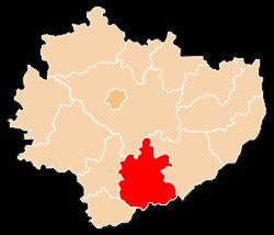
Map of Busko County, Poland
The county covers an area of 967.39 square kilometres (373.5 sq mi). As of 2006 its total population is 73,940, out of which the population of Busko-Zdrój is 17,297 and the rural population is 56,643.
Neighbouring counties
Busko County is bordered by Kielce County to the north, Staszów County to the east, Dąbrowa County to the south, Kazimierza County to the south-west and Pińczów County to the west.
Administrative division
The county is subdivided into eight gminas (one urban-rural and seven rural). These are listed in the following table, in descending order of population.