
Type Highway Length 173 km | Route number(s) State Route 49 | |
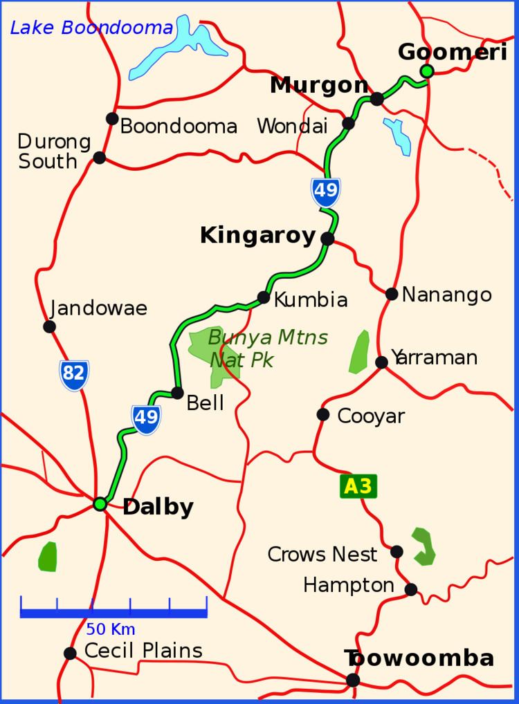 | ||
Major settlements Murgon, Kingaroy, Kumbia, Queensland, Bell | ||
The Bunya Highway is a state highway of Queensland, Australia. It is a relatively short road, running approximately 173 kilometres in a south-westerly direction from Goomeri to Dalby. The highway connects the Warrego and Burnett Highways.
Contents
Map of Bunya Hwy, Queensland, Australia
The Bunya Highway passes near the Bunya Mountains National Park, which is popular with tourists. The highway is named after the Bunya-bunya Araucaria bidwilli, which grows in the area and the seeds of which were (and still are) a favourite food of the Aborigines.
The road continues east of Goomeri as the Wide Bay Highway, connecting it to Gympie.
In 2008, the intersection with Burnett Highway was reconstructed to favour Murgon-bound traffic.
List of towns along the Bunya Highway
References
Bunya Highway Wikipedia(Text) CC BY-SA