
State(s) New York Area 4,059 km² | ||
 | ||
Other cities | ||
The Buffalo-Niagara Falls Metropolitan Statistical Area is a metropolitan area, designated by the United States Census Bureau, encompassing two counties – Erie and Niagara – in Western New York, with a population, as of the 2010 census, of 1,135,509 inhabitants. It is the second-largest metropolitan area in the state of New York, centering on the urbanized area of Buffalo.
Contents
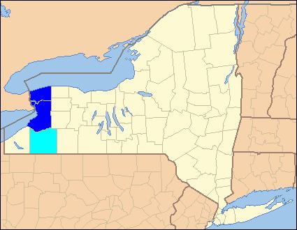
- Map of Buffalo Niagara Falls NY NY USA
- Counties
- Cities
- Indian Reservations
- Demographics
- Major highways
- Combined Statistical Area
- References
Map of Buffalo-Niagara Falls, NY, NY, USA
As of the April 1, 2010, the metropolitan statistical area (MSA) had a population of 1,135,509; the combined statistical area (CSA), which adds Cattaraugus, had a population of 1,215,826 inhabitants. It is part of the Great Lakes Megalopolis, which contains an estimated 54 million people.
In 2010, the Buffalo – Niagara Falls metropolitan statistical area was ranked the 10th best place in the U.S. for working mothers by ForbesWoman magazine.
Counties
Cities
Indian Reservations
Demographics
As of the census of 2000, there were 1,170,111 people, 468,719 households, and 301,970 families residing within the MSA. The racial makeup of the MSA was 83.8% White, 11.7% African American, 0.7% Native American, 1.3% Asian, <0.1% Pacific Islander, 1.2% from other races, and 1.3% from two or more races. Hispanic or Latino of any race were 2.9% of the population.
The median income for a household in the MSA was $38,352. Males had a median income of $38,086 versus $25,589 for females. The per capita income for the MSA was $19,788.
Major highways
Combined Statistical Area
The Buffalo–Niagara–Cattaraugus Combined Statistical Area is made up of three counties in western New York. The statistical area includes one metropolitan area and one micropolitan area. As of the 2010 Census, the CSA had a population of 1,215,826.