
Founded 1858 Population 23,597 (2013) | Area 1,305 km² Unemployment rate 10.8% (Apr 2015) | |
 | ||
Website www.buchanancountyonline.com Rivers Russell Fork, Levisa Fork, Grassy Creek, Knox Creek | ||
Buchanan County is a United States county located on the western border near the far western end of the Commonwealth of Virginia. The county is part of the Southwest Virginia region and lies in the Ridge-and-Valley portion of the Appalachian Mountains. Its county seat is Grundy.
Contents
- Map of Buchanan County VA USA
- History
- Geography
- Districts
- Adjacent counties
- Major highways
- Demographics
- Board of Supervisors
- Constitutional Officers
- Colleges
- Private schools
- Public high schools
- Public elementary and middle schools
- Former schools
- Towns
- Census designated place
- References
Map of Buchanan County, VA, USA
Buchanan County was established in 1858 from parts of Russell and Tazewell counties, and it was named in honor of former President James Buchanan. In 1880, part of Buchanan County was taken to form Dickenson County.
As of the 2010 census, the county population was 24,098, and had a double-digit percentage population decrease over the last three censuses. In addition, as of 2012, Buchanan was the fifth-poorest county in Virginia, when ranked by median household income and has been consistently in bottom 5 % percent over the past decade.
History
The county was formed in 1858 from parts of Russell County and Tazewell County. It was named for James Buchanan, the 15th President of the United States. In 1880 the southwestern part of Buchanan County was combined with parts of Russell County and Wise County to become Dickenson County.
Helen Timmons Henderson (1877–1925) helped participate in the work of the Buchanan Mission School at Council, Va. She and Sarah Lee Fain (1888–1962) of Norfolk became the first two women to be elected into the Virginia General Assembly. They were both Democrats in the House of Delegates. When Helen was in office, the delegates agreed to let 6.2 miles (10.0 km) of improved road to be placed from Russell County, across Big "A" Mountain, to Council. Route 80 is also known as "Helen Henderson Highway, In 1876, Grundy was chosen and became the county seat of Buchanan County, it was named in honor of Felix Grundy, a Senator from Tennessee.
Geography
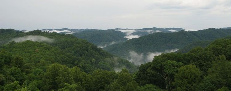
According to the U.S. Census Bureau, the county has a total area of 503.8 square miles (1,304.8 km2), of which 502.7 square miles (1,302.0 km2) is land and 1.1 square miles (2.8 km2) (0.2%) is water. It is home to Poplar Gap Park.
Districts
The county is divided into seven supervisor districts: Garden, Hurricane, Knox, North Grundy, Prater, Rock Lick, and South Grundy.
Adjacent counties
Major highways
Demographics
As of the census of 2000, there were 26,978 people, 10,464 households, and 7,900 families residing in the county. The population density was 54 people per square mile (21/km²). There were 11,887 housing units at an average density of 24 per square mile (9/km²). The racial makeup of the county was 96.75% White, 2.62% Black or African American, 0.06% Native American, 0.14% Asian, 0.10% from other races, 0.33% from two or more races, and 0.47% of the population were Hispanic or Latino of any race.
There were 10,464 households out of which 30.60% had children under the age of 18 living with them, 60.90% were married couples living together, 10.60% had a female householder with no husband present, and 24.50% were non-families. Of all households, 22.50% were made up of individuals and 9.40% had someone living alone who was 65 years of age or older. The average household size was 2.46 and the average family size was 2.87.
In the county, the population was spread out with 21.40% under the age of 18, 8.50% from 18 to 24, 31.20% from 25 to 44, 27.50% from 45 to 64, and 11.50% who were 65 years of age or older. The median age was 39 years. For every 100 females there were 102.90 males. For every 100 females age 18 and over, there were 102.30 males.
The median income for a household in the county was $22,213, and the median income for a family was $27,328. Males had a median income of $29,540 versus $17,766 for females. The per capita income for the county was $12,788. About 19.80% of families and 23.20% of the population were below the poverty line, including 30.20% of those under age 18 and 16.90% of those age 65 or over.
Board of Supervisors
Garden District: Buddy Fuller (R)
Hurricane District: William P. Harris (D)
Knox District: Trey Adkins (D)
North Grundy District: James Carroll Branham (D) (Chairman)
Prater District: Earl Scott (D)
Rocklick District: Craig Stiltner (R)
South Grundy District: Gary Roger Rife(R)
Constitutional Officers
Clerk of the Circuit Court: Beverly S. Tiller (D)
Commissioner of the Revenue: A. Ruth Horn (R)
Commonwealth's Attorney: Gerald D. Arrington (D)
Sheriff: C. Ray Foster (R)
Treasurer: Bill Keene (D)
Buchanan County is represented by Republican A. Benton Chafin in the Virginia Senate, Republican James W. "Will" Morefield in the Virginia House of Delegates, and Republican H. Morgan Griffith in the U.S. House of Representatives.
Colleges
Private schools
Public high schools
All public schools in Buchanan County are operated by Buchanan County Public Schools system.