
Founded 9 February 1613 Website Official website Population 7,079 (2015) | Elevation 2,114 m (6,936 ft) Area 159 km² Local time Sunday 2:06 PM | |
 | ||
Time zone Colombia Standard Time (UTC-5) Weather 18°C, Wind NW at 11 km/h, 61% Humidity | ||
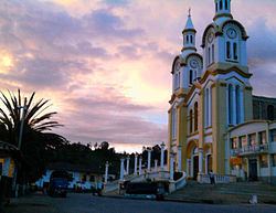
Boavita is a town and municipality in the Colombian Department of Boyacá, part of the subregion of the Northern Boyacá Province. The urban centre of Boavita is situated in the Eastern Ranges of the Colombian Andes at an altitude of 2,114 metres (6,936 ft) and a distance of 184 kilometres (114 mi) from the department capital Tunja. The municipality borders Capitanejo, Santander, and the Nevado River in the north, San Mateo and La Uvita in the east, Tipacoque and Soatá in the west and Susacón in the south.
Contents
Map of Boavita, Boyac%C3%A1, Colombia
Etymology
The name of Boavita is derived from Chibcha and doesn't mean "good life", yet "Point on the hill worshipping the Sun" or "Gate of the Sun".
History
The area of modern Boavita in the times before the Spanish conquest of the Muisca was inhabited by a tribe called "Guavitas", pertaining to the Laches and Muisca. It was ruled by a cacique who was loyal to the Tundama of Tundama.
Modern Boavita was founded on February 9, 1613 by Sr. Hugarte.
Economy
Main economical activities of Boavita are agriculture, livestock farming and mining. Main agricultural products cultivated are dates, sugarcane, yuca, coffee, cotton, potatoes, maize, chick peas, beans, peas, wheat and arracacha. The mining activities exist of carbon exploitation.