
Prominence 301 m | Elevation 1,894 m Easiest route Hiking | |
 | ||
Similar | ||
Hiking in north carolina black balsam knob
Black Balsam Knob, also known as Black Balsam Bald, is in the Pisgah National Forest southwest of Asheville, North Carolina, near milepost 420 on the Blue Ridge Parkway.
Contents
- Hiking in north carolina black balsam knob
- Map of Black Balsam Knob East Fork NC 28716 USA
- Black balsam knob hike
- References
Map of Black Balsam Knob, East Fork, NC 28716, USA
It is the second highest mountain in the Great Balsam Mountains. The Great Balsams are within the Blue Ridge Mountains, which are part of the Appalachian Mountains. It is the 23rd highest of the 40 mountains in North Carolina over 6000 feet.
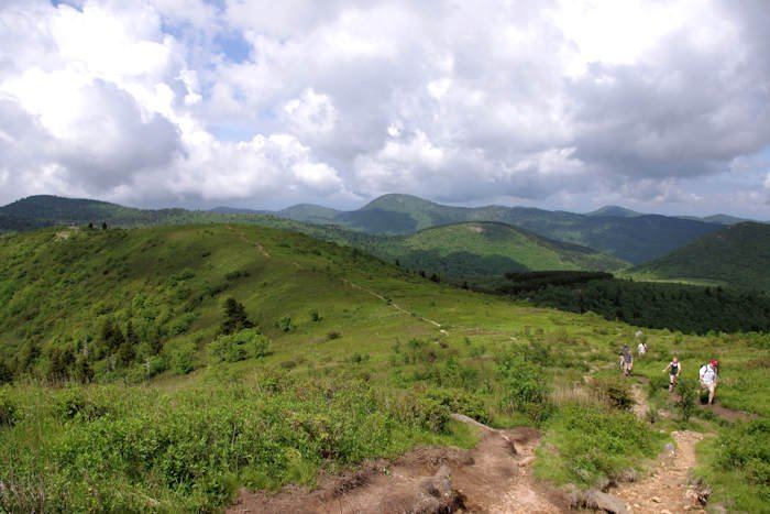
The top of the mountain is a grassy bald that affords a panoramic view. The origin of grassy balds in southern Haywood county is a result of extensive clear-cut logging and locomotive fires in 1925 and 1942. These fires burned deep down into the mineral-rich topsoil slowing reforestation or stopping it altogether. Examples of this cannot only be found on Black Balsam knob, but many of its neighboring peaks and ridges. These unique features contribute greatly to the area's popularity, but the heavy amount of foot traffic also does further damage to this already fragile ecosystem. The Art Loeb Trail follows the grassy ridge of Black Balsam Knob.
Visible peaks from Black Balsam Knob include: