
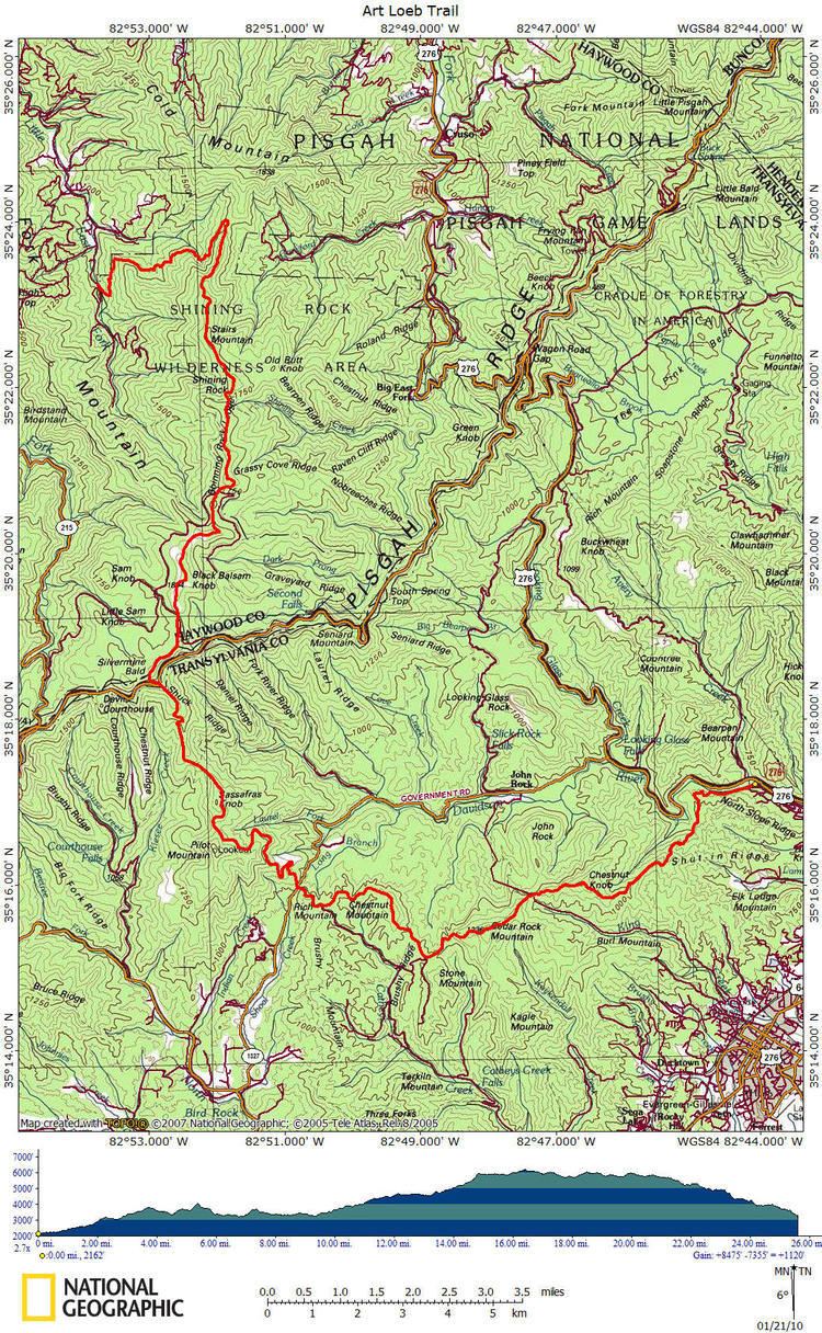
Length 30.1 mi (48.4 km) | Lowest point Davidson River | |
 | ||
Trailheads Davidson River Campground, Daniel Boone Boy Scout Camp Highest point Black Balsam Knob, 6,214 ft (1,894 m) | ||
Art loeb trail thru hike
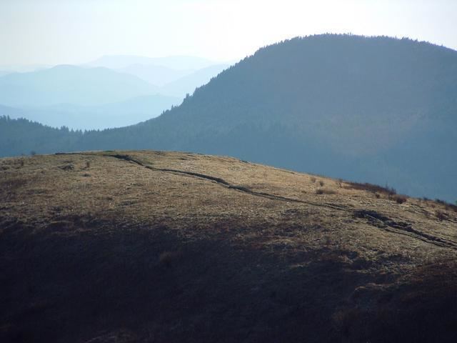
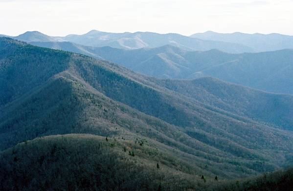
The Art Loeb Trail is a 30.1-mile (48.4 km) trail located in Pisgah National Forest in Western North Carolina. The Northern Terminus is at the Daniel Boone Boy Scout Camp in Haywood County, while the trail's southern Terminus is located near the Davidson River Campground, near Brevard, in Transylvania County. Along the way, the trail traverses several significant peaks, including Black Balsam Knob (6,214 ft), Tennent Mountain (6040 ft) and Pilot Mountain (5095 ft). The trail also passes the base of Cold Mountain, made famous by the novel and film.
Contents
- Art loeb trail thru hike
- Art loeb trail with the hickery brothers part one
- History
- Animals Plants and Geology
- Activities
- References
National Geographic Adventure listed the trail as one of the thirty best North American hikes. They praised the views offered on the high Appalachian Balds, the challenging climbs, and the trail's diverse landscape.

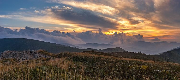
Art loeb trail with the hickery brothers part one
History
Originally part of the Cherokee Nation, the area was heavily logged in the early part of the 20th century.
The Art Loeb Trail was dedicated on November 9, 1969. It was named after an avid hiker and Carolina Mountain Club member, who resided in Brevard. Mr. Loeb often explored and cared for the area.
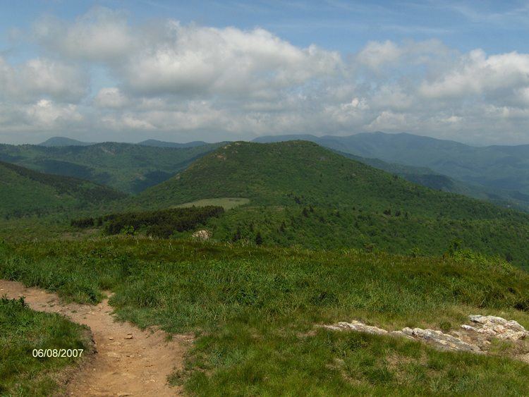
Extensive logging and locomotive fires in 1925 and 1942 are the cause for the expansive, open views around Black Balsam Knob.
Animals, Plants and Geology
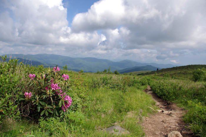
There is a variety of birds, reptiles and mammals in the area. Deer, rattlesnakes, rabbits and bobcats may be spotted by the watchful hiker. While most of the spruce and fir was removed by logging, there are areas where these trees are encountered on the trail. There are significant differences in the landscape from the southern end of the trail compared to the higher elevations.
Along the way, the hiker encounters some unique geology. From Pilot Mountain, there's a view of the Looking Glass Rock pluton. Close to Butter Gap is Cedar Rock, a large granite outcropping. In addition, Shining Rock and its cluster of quartz boulders can be encountered via a side trail.
Activities
The trail sees many hikers taking advantage of the trail's proximity to the Blue Ridge Parkway and Asheville, in addition to literary enthusiasts exploring Cold Mountain. Hikers around in the northern part of the trail in the Shining Rock Wilderness should be prepared, as the trails are not marked, and there are no signs.
South of Ivestor Gap the trail is outside of the Shining Rock Wilderness, and contains blazes and signs to help with navigation. The trail also shares with the Mountains-to-Sea Trail for a short stretch in the Silvermine Bald area. There are also several side trails that connect to the Art Loeb, including the optional climb up Cold Mountain.
Challenges for the hiker include steep ascents and descents, exposed hiking on high Appalachian Balds, and few water supply points.
To complete the entire trail, most guides recommend either three or four days. There are several backcountry camp spots throughout the trail, with primitive shelters at Deep Gap and Butter Gap.
Starting in 2001, an adventure run of the entire trail is held on the Winter Solstice.