
Postal codes 54574 Area 20.88 km² Local time Thursday 6:03 PM Dialling code 06594 | Time zone CET/CEST (UTC+1/+2) Dialling codes 06594 Population 1,198 (31 Dec 2008) Postal code 54574 Municipal assoc. Gerolstein | |
 | ||
Weather 7°C, Wind W at 26 km/h, 53% Humidity | ||
Birresborn is an Ortsgemeinde – a municipality belonging to a Verbandsgemeinde, a kind of collective municipality – in the Vulkaneifel district in Rhineland-Palatinate, Germany. It belongs to the Verbandsgemeinde of Gerolstein, whose seat is in the like-named town.
Contents
- Map of 54574 Birresborn Germany
- Location
- Constituent communities
- Neighbouring municipalities
- Mountains
- Streams
- Adonis Quelle
- Lindenquelle
- Conservation areas
- History
- Municipal council
- Mayors
- Coat of arms
- Natural monuments
- Buildings
- Rail
- Road
- Education
- Church
- Parish priests
- Honorary citizens
- References
Map of 54574 Birresborn, Germany
Location
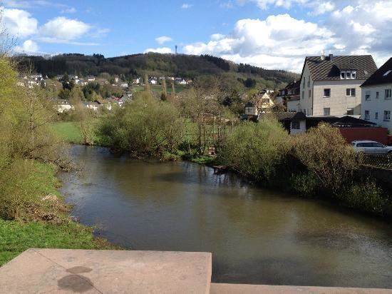
The municipality lies roughly 6 km south of Gerolstein at an elevation of 350 m above sea level in the Kyll valley in the Vulkaneifel, a part of the Eifel known for its volcanic history, geographical and geological features, and even ongoing activity today, including gases that sometimes well up from the earth.
Constituent communities
Birresborn’s Ortsteile are Sauerwasser, the hunting lodge Waldfries and the outlying centre of Rom.
Neighbouring municipalities
Clockwise from the north, these are Gerolstein (7 km away), Michelbach (outlying centre of Gerolstein; 4 km away), Salm (8 km away), Mürlenbach (4 km away), Kopp (4 km away) and Büdesheim (9 km away).
Mountains
Loftier peaks in the municipality include the Rödelkaul (592 m), the Daxberg (548 m), the Goldberg (523 m) and the Vulkan Kalem (509.4 m).
Streams
Adonis Quelle
The Adonis Quelle – Quelle is German for “spring” – lies in the middle of the village, but has been closed since November 2003 owing to contamination. The Quelltempel (“Spring Temple”) also found here near the bridge on the Kyll, in which one could once drink water from the Adonis Quelle and draw it for one’s own use, has likewise been closed ever since.
Lindenquelle
The Lindenquelle lies roughly 4 km north of Birresborn on the way to Gerolstein. The Quelltempel still standing here is under monumental protection, and since 3 July 2009, has been being restored. Moreover, the mineral water is once more gushing forth. The contamination that ended the Adonis Quelle’s usefulness has not affected the Lindenquelle. Here, one can drink water free of charge and also fill up on it the year round.
Conservation areas
Nature conservation areas exist at the Vulkan Kalem, at the ice caves and in the Fischbach valley, in the Felst and in the Hundsbach valley.
History
In 721, Birresborn had its first documentary mention under the name Birgisburias. The prefix Bir— is a word of Semitic origin. It means “well” or “watering place”. Commonly, however, Birgis-burias is translated as “Good Well”.
On 15 June 1871, Birresborn was linked to the German railway network with the opening of the Eifelbahn between Gerolstein and Trier. On 14 May 1908, the Lindenquelle was acknowledged as a public utility. On 20 February 1914, the municipality’s springs were recognized by the state as health springs. On Christmas Day 1944, not long before the Second World War ended, a great part of Birresborn was destroyed in an Allied air raid. Since 1971, Birresborn has been part of the Verbandsgemeinde of Gerolstein, in the Daun district, which is now known as the Vulkaneifel district. On 11 November 2003, the mineral spring Birresborner Phönix Sprudel was closed owing to contamination. On 24 May 2009, the municipality celebrated an “Historic Village Festival” with more than 3,500 visitors from Germany and abroad.
Municipal council
The council is made up of 16 council members, who were elected by proportional representation at the municipal election held on 7 June 2009, and the honorary mayor as chairman.
The municipal election held on 7 June 2009 yielded the following results:
Mayors
Coat of arms
The municipality’s arms might be described thus: Azure in base a mount of three argent charged with and oakleaf in bend sinister vert, above which a spring with four streams of the second.
Natural monuments
Buildings
Rail
The halt at Birresborn lies on the Eifelbahn (Cologne–Euskirchen–Gerolstein–Trier), which here is served by local public rail service between Gerolstein and Trier.
All local public transport is integrated into the Verkehrsverbund Region Trier (VRT), whose fares therefore apply.
Road
Birresborn lies right on Landesstraße 24.
The nearest Autobahnen are as follows:
Education
Birresborn’s only school is the Grundschule Birresborn, a primary school for year grades 1 to 4.
Church
Birresborn is a community whose inhabitants are mainly Catholic. Belonging to the parish of St. Nikolaus Birresborn are also the communities of St. Matthias Kopp, St.Lucia Mürlenbach and Maria Magdalena Densborn. The parish belongs to the Diocese of Trier.