
Length 142 km Source High Fens | Basin size 834 km (322 sq mi) Source elevation 600 m Bridges Kyll Viaduct | |
 | ||
Main source Hautes Fagnes±600 m (2,000 ft) | ||
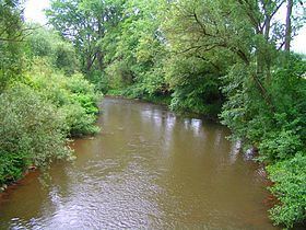
The Kyll ( [ˈkɪl]), noted by the Roman poet Ausonius as Celbis, is a 142 km long river in western Germany (North Rhine-Westphalia and Rhineland-Palatinate), left tributary of the Moselle. It rises in the Eifel mountains, near the border with Belgium and flows generally south through the towns Stadtkyll, Gerolstein, Kyllburg and east of Bitburg. It flows into the Moselle in Ehrang, a suburb of Trier.
Map of Kyll, Germany
References
Kyll Wikipedia(Text) CC BY-SA