
 | ||
Thickness 488 feet (149 m) maximum, (east of Bidahochi, AZ), variable Extent southeast perimeter Black Mesa (Arizona)-NNW; Defiance Plateau-(Uplift)-E & NE; north perimeter foothills White Mountains-S; Painted Desert-NW & W Primary Siltstone, Sandstone, Slate, Tuff, Limestone | ||
The Pliocene to Late Neogene Bidahochi Formation, lies at an elevation of about 6,300 feet (1,920 m) to 6,600 feet (2,012 m) at the southeast of the Colorado Plateau; the deposits are from Bidahochi Lake, (also called Hopi Lake), and the deposits extend southwards to the region at the north perimeter of the White Mountains of central-east Arizona. Bidahochi Lake is thought to have been a single "large lake, or several shallow, and ephemeral ones." Various fossil types are found; also bird trackways.
Contents
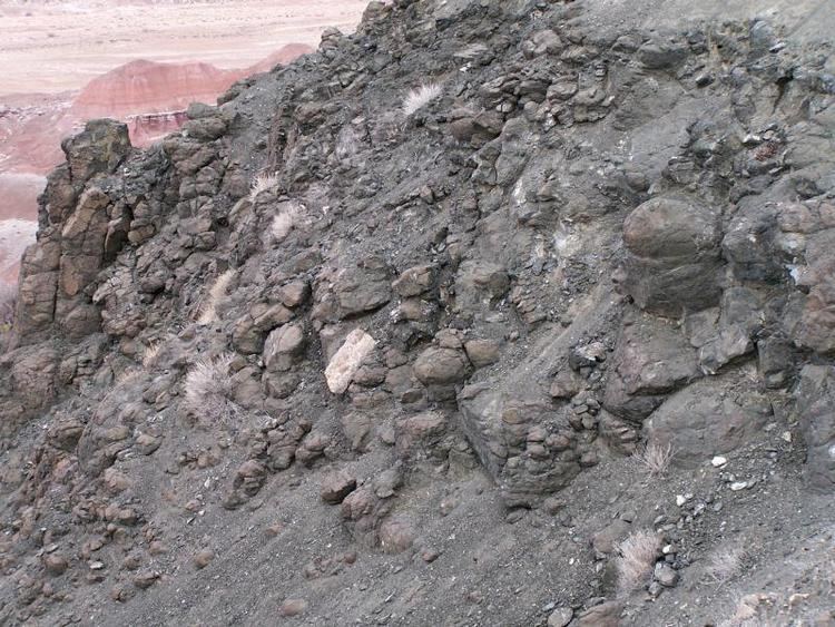
The Bidahochi Formation is a cliff-former unit, and exists on the Colorado Plateau as a protecting unit above the highly erodable Chinle Formation. Locally it immediately overlies other rock units. The Bidahochi Formation extends approximately 112-mi north-south, or north-northwest by south-southeast; the length is approximately equivalent to today's Great Salt Lake of Utah.
The presence of the Bidahochi Formation is a result of two factors. First it lies upon the major water divide of the (south perimeters) Chinle Wash (Chinle Valley) which flows north into the Colorado River watershed; it contrasts with the watershed to the west and south, the Little Colorado River, and the Puerco River tributary from New Mexico; the Defiance Plateau bordering the east of the Bidahochi, sheds water north, west, and south. The second is the timeframe of the Colorado River drainage through Grand Canyon, known to be about 5.5 Ma, where 5.5 Ma marks the beginning of the last deposits in the Bidahochi. The Bidahochi contains, Lower, Middle, and Upper sections, thus the drainages at the beginning of the Colorado River through Grand Canyon is coeval with the end of Bidahochi Lake deposition.
Neogene Colorado Plateau geology
The present geologic status of most of the Colorado Plateau is in a sequence of erosion, caused by wind, water, and time; it is termed an unconformity, since river drainages are removing erosion products from the landscape. Late Paleogene geologic activity continued on the Colorado Plateau (Henry, Abajo, and La Sal Mountains); it continued into the Early Neogene at the San Juan Mountains of southwest Colorado.
Neogene volcanic activity was active on the Colorado Plateau. It ranged from the entire perimeter around the plateau, but also Kaibab Plateau at Grand Canyon, San Francisco Peaks (still active, Sunset Crater), and extended southeast to the Mogollon-Datil volcanic field. Besides alluvial deposits, or Quaternary sand dune deposits, the Bidahochi is possibly the sole geologic formation, that is non-volcanic in origin, during the Neogene, on the Colorado Plateau; it is at least one of the largest, non-volcanic in the Neogene on the plateau.
Present drainages of the Bidahochi
The Bidahochi Formation abuts the Defiance Plateau to the east and northeast; it was uplifted by the Defiance Uplift and is a mountainous, flattened upland. Except the Defiance Plateau's connection in the central-northeast to New Mexico mountains and river drainages, the entire Defiance Plateau is part of the Colorado River drainage.
The north-northwest of the Bidahochi abuts the southeast Black Mesa (Arizona), with drainage to east, then north through Chinle Valley-(Chinle Wash) to the San Juan River, a southeast tributary to the Colorado River. The drainage from the Black Mesa southwest is towards the Little Colorado River, another southeast tributary of the Colorado River.
The south two-fifths of the Bidahochi Formation is cut by the drainage of the southwest-flowing Puerco River out of New Mexico, but the river meets the Little Colorado at the central extent of the Bidahochi-(east to west), and the Little Colorado River then turns northwesterly, then more north-northwesterly to the Colorado River, at Grand Canyon. The entire region north and east of the Little Colorado River is the Painted Desert, composed of the bright, multi-colored, (non-consolidated), highly erodable Chinle Formation. From south of the Little Colorado-Puerco River, (towards the White Mountains), and extending north-northwest to the south of Black Mesa, the Bidahochi lies as a resistant layer, overlying the Chinle, and preventing its erosion in various exposures across the intervening washes, and mesas. In the centerpoint of the transect between the Puerco River, north-northwest to the southeast of Black Mesa is Bidahochi, Arizona. Due west, lies the Hopi Buttes volcanic field, where some of the up 200 vents are maars, erupted through the Bodahochi Formation; the thickest Bidahochi deposits lie due east of the Bidahochi townsite. The Bidahochi forms erosion-resistant, landslide slopes, at the base of specific individual Hopi volcanic buttes.