
- location south of Vittoria - location east of Gooloogong | - elevation 936 m (3,071 ft) - elevation 262 m (860 ft) | |
 | ||
- left Coombing Creek, Mandurama Ponds, Limestone Creek (New South Wales), Jacks Creek (New South Wales) - right Cadiangullong Creek, Swallow Creek, Panuara Rivulet, Nyrang Creek | ||
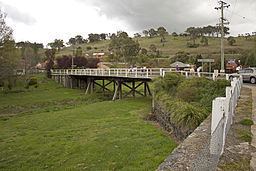
Belubula river canowindra
Belubula River, a perennial river that is part of the Lachlan catchment within the Murray–Darling basin, is located in the central west region of New South Wales, Australia.
Contents
Map of Belubula River, Blayney NSW, Australia
Location and features
The river rises south of Vittoria, midway between Bathurst and Orange and generally flows south and west, joined by eight minor tributaries, flowing through Carcoar Lake where its flow is regulated, before reaching its mouth at the Lachlan River, east of Gooloogong; dropping 674 metres (2,211 ft) over its course of 165 kilometres (103 mi).
The name is derived from the Australian Aboriginal meaning for stony river or big lagoon. The original inhabitants of the land alongside the Belubula River are the Australian Aborigines of the Wiradjuri clan.
Towns on the Belubula River, from its source towards its mouth, include Blayney, Carcoar, and Canowindra.
The New South Wales government has begun the second stage of investigations into a potential new dam of up to 700 gigalitres at Cranky Rock on the Belubula River.