FIPS code 36-05771 Elevation 7.9 m Zip code 11713 Area code 631 | State New York Time zone Eastern (EST) (UTC-5) GNIS feature ID 0943626 Local time Thursday 10:42 AM Population 2,083 (2013) | |
 | ||
Weather 8°C, Wind W at 40 km/h, 35% Humidity Area 3.885 km² (3.885 km² Land / 21 ha Water) | ||
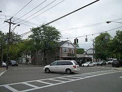
Bellport is a village in Suffolk County, New York, United States. The population was 2,084 at the 2010 census. The village is named after the Bell family, early settlers of the area. The public education system in Bellport makes up the South Country Central School District consisting of six schools, three elementary schools (Kindergarten – grade 3), Frank P. Long Intermediate School (grades 4–5), Bellport Middle School (grades 6–8) and Bellport High School. Bellport is in the town of Brookhaven and is on the South Shore of Long Island. The village is officially known as the Incorporated Village of Bellport.
Contents
- Map of Bellport NY 11713 USA
- Government
- Local business
- History
- Ho Hum Beach
- Notable people
- Geography
- Demographics
- References
Map of Bellport, NY 11713, USA
Government
The village is governed by four trustees and a mayor. Each trustee is elected to a two-year term, with two trustees up for election every year. The mayor is elected to a two-year term as well. The current trustees are: Leslie O'Connor, David McGrath, Michael Ferrigno, and Robert Rosenberg. The mayor of the village is Ray Fell.
Bellport is responsible for many local services such as snow removal, road maintenance, and garbage removal. These services are paid for by taxes on property within the boundaries of the village. However, taxes are collected by the Brookhaven Receiver of Taxes. Education is the responsibility of the South Country Central School District, ambulance service is provided by the South Country Ambulance Company, fire service is provided by the Bellport Fire District, and police service is provided by the Suffolk County Police Department and Bellport Code Enforement.
Local business
There are many small businesses such as antique shops, artist galleries, restaurants, and a service center. These family run businesses get community support through the Bellport Chamber of Commerce. Bellport is also home to the Gateway Playhouse, a professional summer theater in operation since 1950.
History
Bellport was founded by Captains Thomas and John Bell during the early 19th century as a seaport and incorporated as a village in 1910. On July 4, 1980, the Bellport Academy and Bellport Village Historic District were listed on the National Register of Historic Places.
Ho Hum Beach
Ho Hum Beach is located on Fire Island, 2.2 miles (3.5 km) across the Great South Bay from the Bellport Village Marina. Village residents and their guests are welcome to visit the beach. Surfers, sunbathers, and fishermen especially enjoy the privateness of Ho Hum Beach. Ho Hum Beach offers a bathing area, a screened in snack shack and showers on the bay side of the beach. The Whalehouse Point ferry leaves from the Bellport Village Marina, running from late May until early September. Round-trip tickets for the ferry can be purchased by village residents. Guests of village residents may ride the ferry for an increased fare price. Village residents are also welcome to ride their own boats over. Boat slips for non village residents are available at a cost of $65 per day.
Notable people
Geography
The village of Bellport is located at 40°45′25″N 72°56′30″W (40.757034, -72.941603).
According to the United States Census Bureau, the village has a total area of 1.5 square miles (4.0 km2), of which 1.4 square miles (3.7 km2) is land and 0.077 square miles (0.2 km2), or 5.94%, is water.
The village of Bellport is located on the shore of Bellport Bay, an arm of the Great South Bay, one mile south of North Bellport.
Demographics
As of the census of 2000, there were 2,363 people, 993 households, and 684 families residing in the village. The population density was 1,619.7 people per square mile (624.9/km²). There were 1,139 housing units at an average density of 780.7 per square mile (301.2/km²). The racial makeup of the village was 95.13% White, 1.27% African American, 0.38% Native American, 1.65% Asian, 0.08% Pacific Islander, 0.21% from other races, and 1.27% from two or more races. Hispanic or Latino of any race were 1.78% of the population.
There were 993 households out of which 23.0% had children under the age of 18 living with them, 58.4% were married couples living together, 7.8% had a female householder with no husband present, and 31.1% were non-families. 24.5% of all households were made up of individuals and 12.5% had someone living alone who was 65 years of age or older. The average household size was 2.38 and the average family size was 2.86.
In the village, the population was spread out with 18.7% under the age of 18, 4.6% from 18 to 24, 24.0% from 25 to 44, 32.2% from 45 to 64, and 20.4% who were 65 years of age or older. The median age was 46 years. For every 100 females there were 90.6 males. For every 100 females age 18 and over, there were 89.8 males.
The median income for a household in the village was $77,523, and the median income for a family was $80,850. Males had a median income of $51,189 versus $40,985 for females. The per capita income for the village was $38,906. About 0.6% of families and 1.6% of the population were below the poverty line, including 0.9% of those under age 18 and 1.7% of those age 65 or over.
