
Translation point of the pot OS grid SC381860 Prominence 135 m | Elevation 546 m | |
 | ||
Similar Slieau Freoaghane, North Barrule, South Barrule, Snaefell | ||
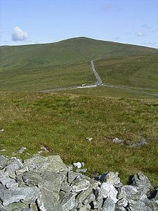
Beinn-y-Phott, known as Penny-Pot, is a peak of 546 metres (1791 feet) on the Isle of Man, about 2 km SW of Snaefell. It is at the southern end of the parish of Lezayre. It is skirted by the Mountain Course used for the TT races and is near Brandywell. It is covered by moorland and a detailed dating of its vegetation through the Holocene period has been made — mostly heathers, peat mosses and sedges.
Map of Beinn-y-Phott, Isle of Man
References
Beinn-y-Phott Wikipedia(Text) CC BY-SA