
City New York City Area 7.205 km² | State New York Population 157,530 (2011) | |
 | ||
ZIP codes 11205, 11206, 11216, 11221, 11233, 11238 Restaurants Bed‑Stuy Fish Fry, Saraghina, Peaches Hot House, Bar LunÀtico, Bedford Hall Hotels Condor Hotel ‑ Williamsb, Prince Classon Hotel, Lafayette Internatio Hostel, 73 mother gaston blvd, Park Manor | ||
Bedford–Stuyvesant (/ˈbɛdfərdˈstaɪvəsənt/; colloquially known as Bed–Stuy and occasionally Stuyford) is a neighborhood of 153,000 inhabitants in the north central portion of the New York City borough of Brooklyn. The neighborhood is part of Brooklyn Community Board 3, Brooklyn Community Board 8, and Brooklyn Community Board 16. The neighborhood is patrolled by the NYPD's 79th and 81st precincts. In the City Council, the district is represented by Robert Cornegy of the 36th Council District.
Contents
- Map of Bedford Stuyvesant Brooklyn NY USA
- Founding
- 17th and 18th centuries
- 19th century
- 1900s to 1950s
- 1960s
- 1970s and 1980s
- 2000s
- 2010s
- Neighborhoods
- Historic district
- Demographics
- Education
- Transportation
- In popular culture
- References
Map of Bedford-Stuyvesant, Brooklyn, NY, USA
Bedford–Stuyvesant is bordered by Flushing Avenue to the north (bordering Williamsburg), Classon Avenue to the west (bordering Clinton Hill), Broadway to the east (bordering Bushwick), and Atlantic Avenue to the south (bordering Crown Heights and Brownsville). It is served by Postal Service ZIP codes 11205, 11206, 11216, 11221, 11233, and 11238. The main north–south thoroughfare is Nostrand Avenue, but the main shopping street is Fulton Street; the latter lies above the main subway line for the area, on the A C trains. Fulton Street runs east–west the length of the neighborhood and intersects high-traffic streets including Bedford Avenue, Nostrand Avenue, and Stuyvesant Avenue. Bedford–Stuyvesant is actually made up of four neighborhoods: Bedford, Stuyvesant Heights, Ocean Hill, and Weeksville (also part of Crown Heights). Part of Clinton Hill used to be considered part of Bedford–Stuyvesant.
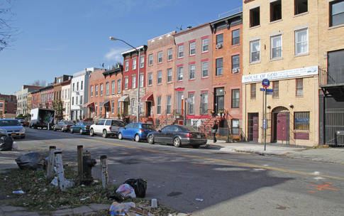
For decades, it has been a cultural center for Brooklyn's African American population. Following the construction of the IND Fulton Street Line in 1936, African Americans left an overcrowded Harlem for greater housing availability in Bedford–Stuyvesant. From Bedford–Stuyvesant, African Americans have since moved into the surrounding areas of Brooklyn, such as East New York, Crown Heights, Brownsville, and Fort Greene. Bedford–Stuyvesant has many historic brownstones. These homes were developed by speculative developers for the expanding middle to upper middle class from the 1890s to the late 1910s. Many of these homes contain highly ornamental detailing throughout the interior of the home and have classical architectural elements, such as brackets, quoins, fluting, finials, and elaborate frieze and cornice banding.
Founding
The neighborhood's name is a combination of the names of the Village of Bedford and Stuyvesant Heights neighborhoods. The name Stuyvesant derives from Peter Stuyvesant, the last governor of the colony of New Netherland.
17th and 18th centuries
In the second half of the 17th century, the lands which comprise the present neighborhood belonged to three Dutch settlers, Dirck Janse Hooghland, who operated a ferryboat on the East River, Jan Hansen and Leffert Pietersen van Haughwout, both farmers. In pre-revolutionary Kings County, Bedford was the first major settlement east of the then Village of Brooklyn on the ferry road to the town of Jamaica and eastern Long Island. Stuyvesant Heights, however, was farmland; the area became a community after the American Revolutionary War. In 1838 the Weeksville subsection was recognized as one of the first free African American communities in the United States.
For most of its early history, Stuyvesant Heights was part of the outlying farm area of the small hamlet of Bedford, settled by the Dutch during the 17th century within the incorporated town of Breuckelen. The hamlet had its beginnings when a group of Breuckelen residents decided to improve their farm properties behind the Wallabout section, which gradually developed into an important produce center and market. The petition to form a new hamlet was approved by Governor Stuyvesant in 1663. Its leading signer was Thomas Lambertsen, a carpenter from Holland. A year later the British capture of New Netherland signaled the end of Dutch rule. In Governor Nicolls' Charter of 1667 and in the Charter of 1686, Bedford is mentioned as a settlement within the Town of Brueckelen. Bedford hamlet had an inn as early as 1668, and in 1670 the people of Breuckelen purchased from the Canarsie Indians an additional area for common lands in the surrounding region.
Bedford Corners, located approximately where the present Bedford Avenue meets Fulton Street, and only three blocks west of the present Historic District, was the intersection of several well traveled roads. The Brooklyn and Jamaica Turnpike, constructed by a corporation founded in 1809 and one of the oldest roads in Kings County, ran parallel to the present Fulton Street, from the East River ferry to the village of Brooklyn, thence to the hamlet of Bedford and on toward Jamaica via Bed–Stuy. Farmers from New Lots and Flatbush used this road on their way to Manhattan. Within the Stuyvesant Heights Historic District, the Turnpike ran along the approximate line of Decatur Street. Cripplebush Road to Newtown and the Clove Road to Flatbush also met at Bedford Corners. Hunterfly Road, which joined the Turnpike about a mile to the east of Clove Road, also served as a route for farmers and fishermen of the Canarsie and New Lots areas.
At the time of the Revolution, Leffert's son Jakop was a leading citizen of Bedford and the town clerk of Brooklyn. His neighbor Lambert Suydam was captain of the Kings County troop of horse cavalry in 1776. An important part of the Battle of Long Island took place in and near the Historic District. In 1784, the people of the Town of Brooklyn held their first town meeting since 1776.
19th century
In 1800, Bedford was designated one of the seven districts of the Town of Brooklyn, and in 1834 it became part of the seventh and ninth wards of the newly incorporated City of Brooklyn.
The present gridiron street system was laid out in 1835, as shown by the Street Commissioners map of 1839, and the blocks were lotted. The new street grid system led to the abandonment of the Brooklyn and Jamaica Turnpike in favor of a continuation of Brooklyn's Fulton Street, which was opened up just south of the Historic District in 1842. The lands for the street system within what is now Bedford–Stuyvesant however were not sold to the City of Brooklyn until 1852. Earlier in the same year Charles C. Betts had purchased Maria Lott's tract of land. This marked the end of two centuries of Dutch patrimonial holdings. Betts, as Secretary of the Brooklyn Railroad Company acquired the land for the horsecar, later trolley, lines on Fulton Street and for investment purposes. Most of the streets were not actually opened, however, until the 1860s. Streets in Bedford–Stuyvesant were named after prominent figures in American history. Francis Lewis was a signer of the Declaration of Independence, whilst Bainbridge, Chauncey, Decatur and MacDonough were naval heroes of the Tripolitan War and the War of 1812. The Dripps Map of 1869 shows that the area was still largely rural with a few freestanding houses mostly on MacDonough Street. The real development of the district began slowly at first, accelerating between 1885 and 1900, and gradually tapering off during the first two decades of the 20th century.
With the building of the Brooklyn and Jamaica Railroad in 1833, along Atlantic Avenue, Bedford was established as a railroad station near the intersection of current Atlantic Avenue and Franklin Avenues. In 1836, the Brooklyn and Jamaica Railroad was taken over by the Long Island Rail Road (LIRR). In 1878, the Brooklyn, Flatbush and Coney Island Railway established its northern terminal with a connection to the LIRR at the same location.
Construction of masonry row houses in the 1870s began to transform the rural district into an urban area. The first row of masonry houses in Stuyvesant Heights was built in 1872 on MacDonough Street for developer Curtis L. North. In the 1880s and 1890s, more rows were added, most of the Stuyvesant Heights north of Decatur Street looked much as it does today. Stuyvesant Heights was emerging as a neighborhood entity with its own distinctive characteristics. The houses had large rooms, high ceilings, and large windows. The people who brought these houses were generally upper-middle-class families, mostly lawyers, shopkeepers, and merchants of German and Irish descent, with a sprinkling of English people; there were also a few professionals. A contemporary description calls it a very well kept residential neighborhood, typical of the general description of Brooklyn as "a town of homes and churches."
Built in 1863, the Capitoline Grounds were the home of the Brooklyn Atlantics baseball team. The grounds were bordered by Nostrand Avenue, Halsey Street, Marcy Avenue, and Putnam Avenue. During the winters, the operators would flood the area and open an ice-skating arena. The grounds were demolished in 1880.
In 1890, the city of Brooklyn founded another subsection Ocean Hill, a working-class predominantly Italian enclave.
In the last decades of the 19th century, with the advent of electric trolleys and the Fulton Street Elevated, Bedford–Stuyvesant became a working-class and middle-class bedroom community for those working in downtown Brooklyn and Manhattan in New York City. At that time, most of the pre-existing wooden homes were destroyed and replaced with brownstone rowhouses.
1900s to 1950s
In 1907, the completion of the Williamsburg Bridge facilitated the immigration of Jews and Italians from the Lower East Side of Manhattan.
During the 1930s, major changes took place due to the Great Depression years. Immigrants from the American South and the Caribbean brought the neighborhood's black population to around 30,000, making it the second largest Black community in the city at the time. During World War II, the Brooklyn Navy Yard attracted many blacks to the neighborhood as an opportunity for employment, while the relatively prosperous war economy enabled many of the resident Jews and Italians to move to Queens and Long Island. By 1950, the number of blacks had risen to 155,000, comprising about 55 percent of the population of Bedford–Stuyvesant. In the 1950s, real estate agents and speculators employed blockbusting to turn a profit. As a result, formerly middle class white homes were being turned over to poorer black families. By 1960, eighty-five percent of the population was black.
1960s
Gang wars erupted in 1961 in Bedford–Stuyvesant. During the same year, Alfred E. Clark of The New York Times referred to it as "Brooklyn's Little Harlem". One of the first urban riots of the era took place there. Social and racial divisions in the city contributed to the tensions, which climaxed when attempts at community control in the nearby Ocean Hill-Brownsville school district pitted some black community residents and activists (from both inside and outside the area) against teachers, the majority of whom were white, many of them Jewish. Charges of racism were a common part of social tensions at the time.
In 1964, race riots broke out in the Manhattan neighborhood of Harlem after an Irish-American NYPD lieutenant, Thomas Gilligan, shot and killed an African American teenager, James Powell, aged 15. The riot spread to Bedford–Stuyvesant and resulted in the destruction and looting of many neighborhood businesses, many of which were Jewish-owned. Race relations between the NYPD and the city's black community were strained as police were seen as an instrument of oppression and racially biased law enforcement; further, at that time, few black policemen were present on the force. In predominantly black New York neighborhoods, arrests and prosecutions for drug-related crimes were higher than anywhere else in the city, despite evidence that illegal drugs were used at at least the same rate in the white community, further contributing to the problems between the white dominated police force and black community. Coincidentally, the 1964 riot took place throughout the NYPD's 28th and 32nd precincts, in Harlem, and the 79th precinct, in Bedford–Stuyvesant, which at one time were the only three police precincts in the NYPD where black police officers were allowed to patrol. Race riots followed in 1967 and 1968, as part of the political and racial tensions in the United States of the era, aggravated by continued high unemployment among blacks, continued de facto segregation in housing, and the failure to enforce civil rights laws.
Following the 1964 election, With the help of local activists and politicians, such as Civil Court Judge Thomas Jones, grassroots organizations of community members and businesses willing to aid were formed and began the rebuilding of Bedford–Stuyvesant. Kennedy's program was soon used as a nationwide model in other large urban areas to fight the War on Poverty.
In 1965, Andrew W. Cooper, a journalist from Bedford–Stuyvesant, brought suit under the Voting Rights Act against racial gerrymandering. The lawsuit claimed that Bedford–Stuyvesant was divided among five congressional districts, each represented by a white Congress member. It resulted in the creation of New York's 12th Congressional District and the election in 1968 of Shirley Chisholm, the first black woman and West Indian American ever elected to the US Congress. In early 1975, when Seatrain Shipbuilding, inside the Brooklyn Navy Yard, experienced a massive layoff of shipbuilders—80% of those affected living in and around Bedford–Stuyvesant—it was Congresswoman Chisholm who came to their rescue. Chisholm convinced the government to restructure existing loans and guarantee new loans backed by the VLCC's Stuyvesant and Bay Ridge so the shipbuilders could resume building them. From 1968 through 1979, Seatrain Shipbuilding was the largest employer inside the Brooklyn Navy Yard, providing an estimated $750 million in economic stimulus to the City of New York by way of its shipbuilding activities in those years.
In 1967, Robert F. Kennedy, who was elected US Senator for the State of New York, was tasked on fighting the war on poverty as race riots broke out across the urban north while the issues of the civil rights movement in southern states were still more of a priority for African American rights activists. Rather than focus on problems facing African Americans outside of New York, Kennedy launched a study of problems facing the urban poor in Bedford–Stuyvesant, which received almost no federal aid and was the city's largest non-white community. The Bedford Stuyvesant Restoration Corporation was established as the United States’ first community development corporation, envisioned by Kennedy, along with Jacob Javits, Elsie Richardson, Franklin A. Thomas, John Doar, and other activists. The Manhattan-based Development and Services Corporation (D&S) was established, which was composed of business, banking and professional leaders which advised and fundraised private funding for the BSRC’s projects.
The abandoned Sheffield Milk bottling plant on Fulton Street was turned into the BRSC offices in 1967; the same year saw the start of the exterior restoration project, which employed local residents to work with contractors to repair facades, restore stoops, fix and replace railings and fences and redo sidewalks. The BSRC bought many housing units in Bedford-Stuyvesant and hired local residents to renovate the units; the BRSC also administered a $73 million mortgage assistance program to encourage African-American homeownership. In 1968, Thomas A. Watson, who was on the board of directors for the D&S, opened an IBM computer cable factory in an abandoned building on the corner of Gates and Nostrand.
As part of the BRSC, architect I.M. Pei implemented a controversial plan to create two superblocks on St. Marks Avenue and Prospect Place, between Kingston and Albany avenues; the project closed the streets off from traffic and cut a pathway mid-block to join the two and fill the street spaces with recreational spaces.
1970s and 1980s
In 1977, a power outage occurred across New York City due to a power failure at the Con Edison Plant. Looters took advantage of the outage, and Bedford–Stuyvesant and neighboring Bushwick were two of the worst-hit areas. Thirty-five blocks of Broadway, the street dividing the two communities, were affected, with 134 stores looted, 45 of which were set ablaze.
In the late 1980s, resistance to illegal drug-dealing included, according to Rita Webb Smith, following police arrests with a civilian Sunni Muslim 40-day patrol of several blocks near a mosque, the same group having earlier evicted drug sellers at a landlord's request, although that also resulted in arrests of the Muslims for "burglary, menacing and possession of weapons", resulting in a probationary sentence.
2000s
Beginning in the 2000s, the neighborhood began to experience gentrification. The two significant reasons for this were the affordable housing stock consisting of brownstone rowhouses located on quiet tree-lined streets and the marked decrease of crime in the neighborhood. The latter is partly attributable to the decline of the national crack epidemic as well as heightened policing. Many properties were renovated after the start of the 21st century, and crime declined. New clothing stores, mid-century collector furniture stores, florists, bakeries, cafes, and restaurants opened, and Fresh Direct began delivering to the area. As a result, Bedford–Stuyvesant became increasingly racially, economically, and ethnically diverse, with an increase of foreign-born Afro-Caribbean and African residents as well as residents of other ethnic backgrounds. As is expected with gentrification, the influx of new residents has contributed to the displacement of poorer residents. In other cases, newcomers have rehabilitated and occupied formerly vacant and abandoned properties.
Through a series of "wallscapes" (large outdoor murals), the campaign honored famous community members, including community activist and poet June Jordan, activist Hattie Carthan, and rapper The Notorious B.I.G. The campaign sought to show off the area's positive accomplishments.
Several long-time residents and business owners expressed concern that they would be priced out by newcomers, whom they disparagingly characterize as "yuppies and buppies [black urban professionals]", according to one neighborhood blog. They feared that the neighborhood's ethnic character would be lost. However, Bedford–Stuyvesant's population has experienced much less displacement of the black population, including those who are economically disadvantaged, than have other areas of Brooklyn, such as Williamsburg and Cobble Hill. Many of the new residents are upwardly mobile middle-income African American families, as well as immigrants from Africa and the Caribbean. Neighborhoods surrounding Bedford–Stuyvesant in Northern and Eastern Brooklyn are also majority black, such as Brownsville, Canarsie, Crown Heights, East Flatbush, Flatlands, Prospect Lefferts Gardens, East New York, and Fort Greene. Together these neighborhoods have a population of about 940,000 and are roughly 82% black, making them the largest concentration of African Americans in the United States.
There was a belief that neighborhood change would benefit all residents of the area, bringing with it greater neighborhood safety and more local jobs and creating a demand for improved retail services along the major commercial strips, such as Fulton Street (recently co-named Harriet Tubman Avenue), Nostrand Avenue, Tompkins Avenue, Greene Avenue, Lewis Avenue, Flushing Avenue, Park Avenue, Myrtle Avenue, Dekalb Avenue, Putnam Avenue, Bedford Avenue, Marcy Avenue, Malcolm X Boulevard, Gates Avenue, Madison Street, and Jefferson Avenue. To that effect, both the Fulton Street and Nostrand Avenue commercial corridors became part of the Bed-Stuy Gateway Business Improvement District, bringing along with it a beautification project that provides various pedestrian and landscape improvements.
In July 2005, the NYPD designated the Fulton Street–Nostrand Avenue business district in Bedford–Stuyvesant as an "Impact Zone". The designation directed significantly increased levels of police protection and resources to the area centered on the intersection of Fulton Street and Nostrand Avenue for a period of six months. During these six months members of notorious gangs such as "Moss Gang" were apprehended. It was renewed for another six-month period in December 2005. Since the designation of the Impact Zone in Bedford–Stuyvesant, crime within the district decreased 15% from the previous year. The police department has ranked Bedford–Stuyvesant as one of the neighborhoods that has experienced a steady decline in crime and has had improved safety. Despite the improvements and increasing stability of the community, Bedford–Stuyvesant has continued to be stigmatized in some circles. In March 2005 a campaign was launched to supplant the "Bed-Stuy, Do-or-Die" slogan with "Bed-Stuy, and Proud of It". Also, the threat of crime taking over certain neighborhoods did not disappear, as violent crime remains a problem in the area. Much like Brownsville and East New York, Bed-Stuy is well known for drive-bys, robberies, murders, and assaults. The two precincts that cover Bedford–Stuyvesant reported a combined 37 murders in 2010. The 81st precinct was also accused in 2010 of not reporting crimes and recording felonies as misdemeanors to make the crime rate appear lower.
2010s
Despite the largest recession to hit the United States in the last 70 years, gentrification continues steadily throughout the neighborhood, if not accelerated by the relatively affordable prices of living in Bedford–Stuyvesant. The strong community and abundance of historic brownstone townhouses in the neighborhood contribute to its growth. Since 2008 a score of new cafes, restaurants, bakeries, boutiques, galleries, and wine bars have sprung up in the area, with concentrated growth along the western and southern parts of the neighborhood; the blocks north of the Nostrand Avenue and Fulton Street intersection and west of Fulton Street and Stuyvesant Avenues were particularly impacted. In 2011, Bedford–Stuyvesant listed three Zagat-rated restaurants for the first time. Today there are over ten Zagat-rated establishments, and in June 2013, 7 Arlington Place, the setting for Spike Lee's 1994 film Crooklyn, was sold for over its asking price, at $1.7 million.
A diverse mix of students, hipsters, artists, creative professionals, architects, and attorneys of all races continue to move to the neighborhood. A business improvement district has been launched along the Fulton and Nostrand Corridor with a redesigned streetscape to include new street trees, street furniture, pavers, and signage and improved cleanliness in an effort to attract more business investment. Major infrastructure upgrades have been performed or are in progress, such as Brooklyn's first Select Bus Service route, the B44 SBS Bus Rapid Transit service along Nostrand and Bedford Avenues, which began operating in late 2013. Other infrastructure upgrades in the neighborhood includes major sewer and water modernization projects. Verizon FiOS and Cablevision also continue to expand high-speed fiber-optic and cable service to the area. Improved natural and organic produce continue to become available at local delis and grocers, the farmer's market on Malcolm X Boulevard, and through the Bed-Stuy Farm Share. FreshDirect services the neighborhood, and a large member constituency of the adjacent Greene-Hill Food Coop are from Bedford–Stuyvesant.
In spring 2013, the Bedford–Stuyvesant YMCA received a $25,000 donation from DKNY following the wishes of a resident photographer whose work had been used by the company without his permission.
On December 20, 2014, two NYPD officers were killed in the neighborhood, supposedly in revenge for the death of Eric Garner and the shooting of Michael Brown. The suspect then committed suicide after being chased by other police officers onto the subway.
Neighborhoods
Historic district
Stuyvesant Heights Historic District is a national historic district in Bedford-Stuyvesant that consists of 577 contributing residential buildings built between about 1870 and 1900. The district encompasses 17 individual blocks (13 identified in 1975 and four new in 1996). The buildings within the district consist primarily of two and three-story rowhouses with high basements, with a few multiple dwellings and institutional structures. The district includes the Our Lady of Victory Catholic Church, the Romanesque Revival style Mount Lebanon Baptist Church, and St. Phillip's Episcopal Church. It was listed on the National Register of Historic Places in 1975 and expanded in 1996. Bedford Stuyvesant/Expanded Stuyvesant Heights Historic District was designated on April 16, 2013 and extended the district north to Jefferson Ave, east to Malcolm X Blvd, and west to Tompkins Avenue.
Demographics
African Americans migrated from the Southern United States in the early- to mid-20th century, pursuing what they perceived as the racial equality and freedoms of the north. This movement is known as the Great Migration. Many African Americans moved north in search of new industry. The Bedford–Stuyvesant neighborhood became a popular landing ground for African Americans. The New York Times wrote in July 2014 that the area was "diverse and changing" and that, "The sprawling Brooklyn neighborhood of Bedford-Stuyvesant is famous for its African-American heritage and beautiful brownstone architecture." As of the 2010 census, Bed-Stuy was 70.1% Black, 15% Hispanic, 10.1% White, 1.8% Asian, and 3% other. As of 2014, Bedford–Stuyvesant is still a predominantly African American neighborhood, though there are populations of Hispanic and White populations that are growing. According to the American Community survey, in 2013 the population was 56% Black, 22% White, 19% Hispanic, 2% Asian, and 2% other or from two or more races
Education
Several public schools serve Bedford-Stuyvesant. The zone high school for the neighborhood is Boys and Girls High School on Fulton Street. At the eastern edge of the neighborhood is Paul Robeson High School for Business and Technology.
For the early grades (kindergarten and first grade in 2012), Success Academy Bed-Stuy 1 and 2 are charter schools; one is open and the other opened in August 2012. Bed-Stuy is also home to the Brooklyn Waldorf School, which moved to Claver Castle (at 11 Jefferson Avenue) in 2011.
Other institutions include:
Transportation
Bedford–Stuyvesant is served by several New York City Bus Brooklyn bus routes.
It is served by the New York City Subway IND Fulton Street Line (A C trains), which opened in 1936. This underground line replaced the earlier, elevated BMT Fulton Street Line on May 31, 1940. The IND Crosstown Line (G train), running underneath Lafayette Avenue and Marcy Avenue, opened for service in 1937. The elevated BMT Jamaica Line (J M Z trains), the city's oldest subway line because of its having opened in 1885, also serves the neighborhood, running alongside its northern boundaries at Broadway. Bedford–Stuyvesant is also served by the Nostrand Avenue and East New York stations of the Long Island Rail Road.
Until 1950, the BMT Lexington Avenue Line served Lexington Avenue in the neighborhood. Likewise, the BMT Myrtle Avenue Line served Myrtle Avenue in the north until 1969.